Area Overview for Bradbury and the Isle
Photos of Bradbury and the Isle
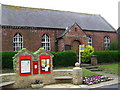
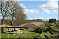
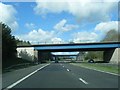
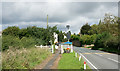

Area Information
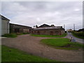
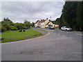
Bradbury and the Isle is a civil parish covering a total area of 13.1 square kilometres in England. Living in Bradbury and the Isle means navigating a landscape defined by its modest size and established character. You are purchasing into a settlement where the physical footprint is manageable, yet the community has a distinct identity. The parish combines residential space with local history, offering a specific pace of life that differs from densely built urban fringes. Your daily routine here will revolve around immediate local amenities rather than long commute strips. The area provides a grounded environment where residents interact within a familiar boundary. When you consider homes in Bradbury and the Isle, you are entering a space where the layout dictates a quiet, residential focus. The geography supports a self-contained lifestyle without the density of a larger town centre. Life in this parish involves an appreciation for open space and a clear separation from high-traffic corridors. The 13.1 sq km figure indicates that infrastructure is likely linear or clustered rather than sprawling. You will find that Bradbury and the Isle offers stability through its limited scale. Potential buyers should view this size as an asset, ensuring you are investing in a manageable neighbourhood where local governance and community spirit remain concentrated.
- Area Type
- Parish
- Area Size
- 13.1 km²
- Population
- Not available
- Population Density
- Not available
Demographics
The community profile of Bradbury and the Isle reflects a significant shift towards older living cycles. The median age stands at 70 years, indicating a population dominated by retirees and established residents. Homes in Bradbury and the Isle are primarily suited to this demographic, with very few young families or children evident in the current housing stock. This age distribution shapes local services, transport needs, and the general social atmosphere. Ownership defines the economic fabric of the parish, with 87% of households owned outright or with a mortgage. This high level of home ownership suggests financial stability among residents and a reluctance to move frequently. Consequently, the market moves slowly as properties change hands. The accommodation type and household composition data reinforce a picture of settled, permanent residents rather than transient workers or student populations. Diversity in Bradbury and the Isle follows broader regional trends for the parish level, though specific breakdowns are not detailed in current records. Religion and ethnic group statistics are aggregated at the parish level, reflecting the settled nature of the population. The dominance of the 70 median age implies that local shops and transport options must cater to an elderly demographic. You will encounter a social environment where neighbourly ties are often long-standing and intergenerational interaction is less common than in younger areas.
Household Size
Accommodation Type
Tenure
Ethnic Group
Religion
Household Composition
Age
Household Deprivation
NS-SEC
Explore more demographic insights in this area
Go to Demographics tabPlanning
Planning Constraints
- Flood RiskPremium
- Ramsar Wetland SitesPremium
- Area of Outstanding Natural BeautyPremium
- Protected Nature ReservePremium
- Protected WoodlandPremium
- Crime RiskPremium