Area Overview for Birtley
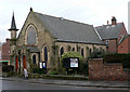
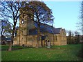
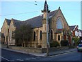
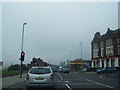
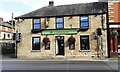
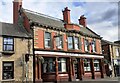
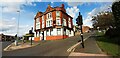
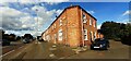
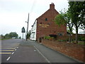
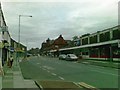
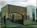
Photos of Birtley

Area Information
Birtley is a built-up area located in England with a total size of 5.4 km². It functions as a distinct residential community where daily life revolves around practical access to nearby towns and modern infrastructure. The area offers a straightforward environment for residents who value connectivity while avoiding the density of larger city centres. You can expect a neighbourhood character defined by its proximity to key retail hubs like Makro Washington and Aldi Blackfell, all of which are within practical reach. Digital infrastructure supports a modern lifestyle, with fixed broadband quality reaching a score of 93 out of 100. Mobile network performance also remains robust at 85 out of 100, ensuring reliable communication for remote workers and families alike. The size of the area suggests a compact living arrangement where services are not excessively distant. Living in Birtley means having a home base that balances newer digital conveniences with established local amenities. The environment is suited to individuals seeking a specific balance between accessibility and a contained residential footprint without the vast sprawl of major metropolitan zones.
- Area Type
- Built Up Area 250
- Area Size
- 5.4 km²
- Population
- Not available
- Population Density
- Not available
Daily life in Birtley benefits from a range of amenities within practical reach, ensuring convenience for residents. Retail options include five notable locations, specifically Morrisons Birtley, Makro Washington, and Aldi Blackfell, providing easy access to groceries and large household goods. Transport links are supported by five railway entities such as Station Road, Chester, and Bullion Lane, facilitating foot or public travel connectivity. Five metro areas including Felling, Pelaw, and Gateshead Stadium frame the broader transport context for those planning longer journeys. Bus services are available at Rhodes Street, though fewer in number compared to rail options. This network allows you to access local shops and travel further afield easily. The combination of specific retail stores and transport points creates a functional lifestyle where daily necessities and transit are accessible without excessive driving.
Amenities
Schools
There are five primary schools located near Birtley, providing educational options for local families. Ravensworth Terrace Primary School holds a good Ofsted rating, alongside Barley Mow Primary School, Birtley East Community Primary School, and Portobello Primary School. These institutions share the same high standard of quality. George Street Junior and Infant School operates in the area but does not have a recorded Ofsted rating in the provided information. The presence of four schools with a good rating indicates a consistent level of educational provision within the vicinity. This mix gives you multiple choices for children's education without relying on a single institution. The concentration of primary education suggests the area caters well to young families. Living in Birtley offers access to specifically named establishments like Barley Mow Primary School without needing to travel to distant towns for schooling.
| Rank | A + A* % | School | Type | Entry gender | Ages |
|---|---|---|---|---|---|
| 1 | N/A | Ravensworth Terrace Primary School | primary | N/A | N/A |
| 2 | N/A | George Street Junior and Infant School | primary | N/A | N/A |
| 3 | N/A | Portobello Primary School | primary | N/A | N/A |
| 4 | N/A | Birtley East Community Primary School | primary | N/A | N/A |
| 5 | N/A | Barley Mow Primary School | primary | N/A | N/A |
Explore more schools in this area
Go to Schools tabDemographics
Specific details regarding the age profile, household types, home ownership levels, and accommodation types in Birtley are not included in the provided information. Consequently, it is not possible to describe the diversity of the community, the proportion of renting versus owner-occupiers, or the specific deprivation data relevant to quality of life. Without these exact figures, any attempt to characterise the demographic mix would be speculative rather than factual. A prospective buyer must rely on the physical attributes and available service data that are confirmed, such as the presence of five named primary schools and the scores for digital connectivity. The absence of detailed census data limits the ability to paint a full picture of the local population's makeup in terms of income, tenure, or age distribution. You should approach the area knowing that concrete statistics on who lives here are not available in this report.
Household Size
Accommodation Type
Tenure
Ethnic Group
Religion
Household Composition
Age
Household Deprivation
NS-SEC
Explore more demographic insights in this area
Go to Demographics tabPlanning
Planning Constraints
- Crime RiskLocked