Area Overview for Billingham South Ward
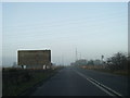
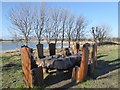
Photos of Billingham South Ward
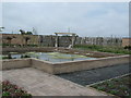
![Bottom Tank, RSPB Saltholme [1] in Billingham South Ward](https://images.propbar.co.uk/images/geograph/44/20/4420685_120.jpg)
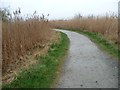
![Northern Reedbed, RSPB Saltholme [1] in Billingham South Ward](https://images.propbar.co.uk/images/geograph/44/20/4420790_120.jpg)
Area Information
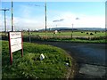
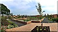
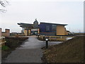
Billingham South Ward sits at the northern edge of the River Tees, forming a distinct community within the Borough of Stockton-on-Tees unitary authority. This ward spans approximately 35.5 square kilometres and is home to 1,664 people, offering a quiet suburban setting for those who value space and history. The local area derives its name from Anglo-Saxon origins, reflecting centuries of settlement that have evolved from a village dating back to the 9th or 10th century into a modern town centre established after the Second World War. Currently, the ward comprises five distinct areas within the town, including Billingham Central and the East and North wards, yet it maintains its own unique identity on the landscape. Living in this part of Billingham means accessing a mix of historic village charm and planned residential estates that have expanded since the 1950s. You remain close to significant natural features, including the Billingham Beck Valley Country Park, a 120-acre site reclaimed from industrial waste and designated a Local Nature Reserve. The town centre itself anchors daily life with prominent national retailers like Asda, which opened its doors in 1967 as the oldest continuously trading example in the UK. While specialist railway services are not detailed in current guides, the area benefits from major road links via the A19 and A689, connecting you to Sunderland, Thirsk, and Hartlepool. Buying a home here places you within easy reach of Middlesbrough and Stockton, ensuring convenient access to wider north-east England while enjoying a local atmosphere shaped by its industrial heritage and recent administrative reforms.
- Area Type
- District Borough Unitary Ward
- Area Size
- 35.5 km²
- Population
- 1664
- Population Density
- 1006 people/km²
Demographics
The community profile of Billingham South Ward reveals a mature population that differs significantly from the national average. With a median age of 70 years, the ward attracts an older demographic, where the most common age range represents the total population rather than a specific youth or working-age cohort. This demographic shift has important implications for local needs, suggesting a higher demand for healthcare services and leisure facilities suitable for retirees. You can expect to encounter a settled neighbourhood where long-term residents often form strong social networks, particularly given the proximity to historic landmarks such as St Cuthbert's church. Home ownership remains a defining feature of daily life in this ward, with 58% of households owning their property outright or with a mortgage. This figure indicates a stable community where many families have put down roots over decades, contributing to a generally consistent local character. Household composition data confirms that the total population reflects these established ties, although specific breakdowns regarding single-person versus multi-generational households are not detailed in the current records. Accommodation types mirror this stability, supporting a range of housing stock from traditional homes around the older village centre to the more contemporary developments found in the eastern estates. The 1,664 residents spread across 35.5 square kilometres result in a density of 1,006 people per square kilometre. This density ensures that while you enjoy access to green spaces like Cowpen Bewley Country Park, you are not fighting for space in a crowded urban core. The absence of specific data on predominant ethnic groups suggests a relatively homogenous community, likely reflective of the historical formation of the area.
Household Size
Accommodation Type
Tenure
Ethnic Group
Religion
Household Composition
Age
Household Deprivation
NS-SEC
Explore more demographic insights in this area
Go to Demographics tabPlanning
Planning Constraints
- Flood RiskPremium
- Ramsar Wetland SitesPremium
- Area of Outstanding Natural BeautyPremium
- Protected Nature ReservePremium
- Protected WoodlandPremium