Area Overview for Billingham North Ward
Photos of Billingham North Ward
Area Information
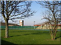
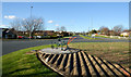
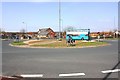
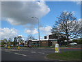
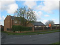
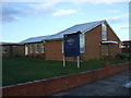
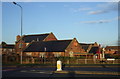
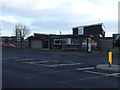
Billingham North Ward occupies a distinct position within the Stockton-on-Tees unitary authority, serving as an electoral ward roughly 1.5 km² in size. This district lies on the north side of the River Tees, forming part of the larger Billingham parish which is the largest by area in the borough. The area includes communities such as Haverton Hill and Port Clarence, creating a neighbourhood defined by its established character and geographical setting. Historically, the settlement dates to Anglo-Saxon times, evolving from a township and urban district before becoming part of the County Borough of Teesside. Modern residents benefit from proximity to key roadways, specifically the A19 connecting to Sunderland and Thirsk, and the A689 linking towards Hartlepool and Bishop Auckland. The local economy is underpinned by significant industrial operations, including Growhow manufacturing and the Belasis Business Park, alongside retail options in Billingham Town Centre. Living in this ward means engaging with an area that balances historical depth with contemporary industrial activity. The ward was subject to boundary changes in 2023, reflecting evolving local governance structures. Potential buyers should consider this context when visualising daily life across this specific sector of the town.
- Area Type
- District Borough Unitary Ward
- Area Size
- 1.5 km²
- Population
- Not available
- Population Density
- Not available
Demographics
The community within Billingham North Ward is characterised by a notably mature population, with a median age of 70. Age data indicates that the total demographic is the most common classification within the area, suggesting a settlement where the retirement age bracket predominates. Home ownership stands at 81%, signifying that the vast majority of residents own their property outright or via mortgage. This high level of ownership correlates with an older demographic where equity has likely been accumulated over decades. Accommodation type data aggregates the total housing stock without specifying new builds versus heritage properties, though the home ownership figure strongly implies an established residential fabric. Diversity data currently aggregates total figures for ethnic groups and religion without providing a specific breakdown, pointing to a relatively homogeneous population structure typical of areas with deep historical roots. The absence of renters in the general description, combined with the 81% ownership rate, suggests a stable environment where residents have long-term ties to the locality. This profile means the neighbourhood is likely quiet, with fewer families with young children and more stability for those seeking a settled environment.
Household Size
Accommodation Type
Tenure
Ethnic Group
Religion
Household Composition
Age
Household Deprivation
NS-SEC
Explore more demographic insights in this area
Go to Demographics tabPlanning
Planning Constraints
- Flood RiskPremium
- Ramsar Wetland SitesPremium
- Area of Outstanding Natural BeautyPremium
- Protected Nature ReservePremium
- Protected WoodlandPremium