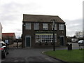
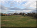
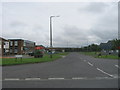
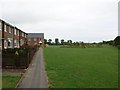
Area Overview for Billingham East Ward
Photos of Billingham East Ward
Area Information
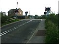
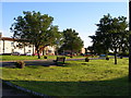
Living in Billingham East Ward offers a very specific type of county living within a district unitary authority context. This area covers just 2.8 square kilometres, making it a compact neighbourhood where daily essentials are within easy reach. The location reflects a mature settlement pattern rather than a developing estate, which shapes the rhythm of daily life. You are looking at a devised ward structure that serves as a distinct part of the Borough of Stockton-on-Tees. The physical footprint is small enough that you likely know most neighbours, yet it maintains the boundaries of an official electoral ward. The area stands apart from larger suburban sprawls because of its defined scale and established character. Residents navigate a well-settled environment where the community identity is rooted in its history and long-standing patterns. When you consider purchasing a property here, you are entering a space with a clear, manageable size that avoids the fragmentation of larger municipalities. The ward operates independently enough to have its own profile but remains fully integrated into the wider local council services. Your experience here will be defined by this concentration of residents and the stability of the district borough unitary structure.
- Area Type
- District Borough Unitary Ward
- Area Size
- 2.8 km²
- Population
- Not available
- Population Density
- Not available
Demographics
The community in Billingham East Ward skews significantly older than the national average, with a median age of seventy years. This demographic profile is consistent across the total population, indicating a population dominated by retirement-age residents. You will find that the area is not built around raising young families or attracting a youthful workforce. The household composition and accommodation type statistics reflect this senior-dominant structure, although the raw figures for specific breakdowns are not detailed in the current dataset. Home ownership remains a central feature of life here. Approximately sixty-three per cent of residents own their homes outright or with a mortgage. This high rate of ownership suggests a stable, settled community where people have put down roots over long periods. The demographic data indicates that the most common age range encompasses the total population, reinforcing the notion that this is an area focused on later life rather than early adulthood. You should not expect a scene dominated by students or young professionals. Diversity details regarding predominant ethnic groups, religion, and specific household compositions are not broken out in the available tables. Consequently, the narrative relies heavily on the age and ownership metrics provided. For a buyer looking at this demographic, the primary takeaway is a greying population where estate services and local amenities are likely tailored to an older clientele. The sixty-three per cent ownership figure is the strongest indicator of the social fabric, showing a landscape defined by people who have stayed rather than moved in for a temporary stint.
Household Size
Accommodation Type
Tenure
Ethnic Group
Religion
Household Composition
Age
Household Deprivation
NS-SEC
Explore more demographic insights in this area
Go to Demographics tabPlanning
Planning Constraints
- Flood RiskPremium
- Ramsar Wetland SitesPremium
- Area of Outstanding Natural BeautyPremium
- Protected Nature ReservePremium
- Protected WoodlandPremium