Area Overview for Bank Top & Lascelles Ward
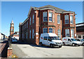
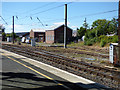
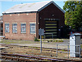
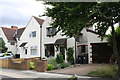
Photos of Bank Top & Lascelles Ward

Area Information
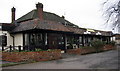
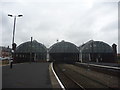
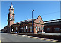
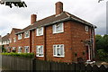
Bank Top & Lascelles Ward forms a distinct neighbourhood within the heart of Darlington, serving as a key residential unitary authority ward. This compact district spans just 1.1 square kilometres and houses 1,077 residents. Situated at coordinates 54.518748, -1.538300, the area sits centrally within the town, bordering Yarm Road. While some broader records suggest a wider ward population of approximately 10,770 people across the full Darlington borough context, the specific ward data points to a concentrated community of over one thousand families. The location grants immediate access to the town centre, positioning residents between the historic market area and the industrial zones. You will find yourself living in a setting that is most certainly Bang Top & Lascelles Ward. Daily life here relies on proximity to established amenities rather than rural isolation. The area functions as a dense urban pocket where street-level retail and local services are within walking distance. This densification means that noise and vitality are constant companions. The ward is defined by its integration into the broader Darlington urban fabric. You should expect a mature environment where services are accessible without the need for lengthy car journeys. The boundaries are respected, yet the infrastructure connects directly to the main thoroughfares of the city.
- Area Type
- District Borough Unitary Ward
- Area Size
- 1.1 km²
- Population
- 1077
- Population Density
- 979 people/km²
Demographics
The community profile of Banks Top & Lascelles Ward reveals an exceptionally mature living environment. The median age within the ward sits at 70 years old, indicating that the majority of residents are retirees or older adults. Most households consist of single-person families or couples where children have moved away. This age structure has a direct impact on home ownership statistics, with 51% of homes owned outright or with a mortgage. The remaining residents are largely tenants or those supporting adult children. Household composition data highlights the dominance of older age groups over any younger demographics. You will not find a significant influx of young professionals or students in this specific zone. The population density reaches 979 people per square kilometre, creating a busy atmosphere despite the small footprint. Low population growth aligns with the retirement demographic. Ethnic diversity and religious adherence data are not explicitly quantified in the available records for this specific ward. Instead, the social fabric is defined by the long-term settlement of older couples. Deprivation indicators are not provided in the current dataset, so you must evaluate local services based on general town standards.
Household Size
Accommodation Type
Tenure
Ethnic Group
Religion
Household Composition
Age
Household Deprivation
NS-SEC
Explore more demographic insights in this area
Go to Demographics tabPlanning
Planning Constraints
- Flood RiskPremium
- Ramsar Wetland SitesPremium
- Area of Outstanding Natural BeautyPremium
- Protected Nature ReservePremium
- Protected WoodlandPremium