Area Overview for Backworth & Holystone Ward
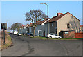
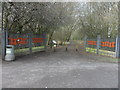
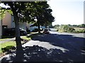
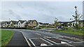
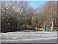
Photos of Backworth & Holystone Ward


Area Information
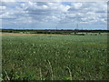
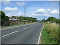
Living in Backworth & Holystone Ward offers a distinct experience within your local district. This ward covers a compact area of 9.1 km², creating a sense of intimacy for residents. You will find a community where daily life moves at a different pace compared to the wider city. The geography is small enough that neighbours often know each other by sight, yet the ward has enough character to feel like its own entity. The setting is quiet, focusing on residential stability rather than the hustle of major commercial hubs. For you, a prospective buyer, this means a neighbourhood defined by settled routines and established local patterns. It is a place where the focus remains on home and family rather than the demands of the wider urban sprawl. The small physical footprint ensures that you are never far from your doorstep, whether walking to a local shop or taking a short drive. This compactness defines the character of the ward, making it a specific choice for those seeking a low-key lifestyle. The area stands out for its quiet nature, which contrasts with many other more densely populated parts of the borough. You are entering a community that values its existing housing stock and the people who live there. This small size means that new developments are often tightly planned to fit within the existing landscape.
- Area Type
- District Borough Unitary Ward
- Area Size
- 9.1 km²
- Population
- Not available
- Population Density
- Not available
Demographics
The community in Backworth & Holystone Ward has a clearly defined age profile. The median age is 70, indicating that the majority of residents are older adults. This demographic profile shapes every aspect of life within the ward. You will find that services and local amenities cater primarily to this older population. The home ownership rate is exceptionally high, standing at 73%. This high level of ownership creates a stable environment where residents have long-term roots in the area. Most households consist of individuals or couples living in their own homes rather than renting. The accommodation type reflects this stability, with a large proportion of dwellings being family properties or retirement-style homes. You might notice that the area feels peaceful because so many residents have lived here for decades. The diversity of the population should be noted, though specific ethnic breakdowns are not detailed in the available figures. The religious composition also follows general trends without specific categorical data provided. What matters most for you is the stability of the neighbours you will meet. A 70-year-old median age suggests a quieter street where noise levels remain low. The 73% home ownership rate confirms that this is an area built on permanent residence. This stability often leads to well-maintained properties and a community that looks after itself. When you consider homes in Backworth & Holystone Ward, you are buying into a community of long-term residents who value their neighbourhood.
Household Size
Accommodation Type
Tenure
Ethnic Group
Religion
Household Composition
Age
Household Deprivation
NS-SEC
Explore more demographic insights in this area
Go to Demographics tabPlanning
Planning Constraints
- Flood RiskPremium
- Ramsar Wetland SitesPremium
- Area of Outstanding Natural BeautyPremium
- Protected Nature ReservePremium
- Protected WoodlandPremium