Area Overview for Amble By the Sea
Photos of Amble By the Sea


Area Information
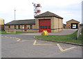
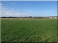
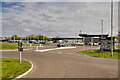
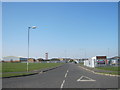
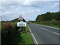
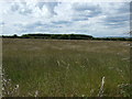
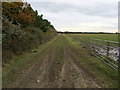
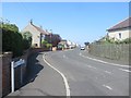
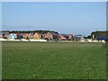
Amble by the Sea stands as a distinct civil parish within Northumberland, situated at the mouth of the River Coquet where it meets the North Sea. This coastal town covers an area of 5.9 km² and occupies a strategic position approximately nine miles south of Alnwick and a mile southeast of Warkworth. Originally a small hamlet, the location transformed significantly in the 1830s following harbour development, evolving into an important port for the region. John Rennie designed the breakways completed in 1849, which remain a central feature of the landscape today. The area retains its historic identity as a fishing community, historically known as the Kindliest Port after locals famously farewelled the RMS Mauretania on its final voyage in 1935. Daily life here revolves around the practical needs of a coastal settlement with deep maritime roots. The town centre aligns with the High Street and the later developed main street created by 1837. You will find the area is anchored by Harrison's yard, a traditional coble boat-building business founded in 1870, and the historic Amble Harbour, which served as the smallest port servicing the Northumberland and Durham coalfields. Although the river course shifted during the 1764 floods, the town adapted and flourished through the 19th century with the opening of coal collieries at Broomhill and Radcliffe. The parish was officially renamed Amble by the Sea on 29 November 1976, marking a formal recognition of its coastal character. Living in Amble by the Sea means inhabiting a place where industrial heritage and maritime tradition define the local rhythm.
- Area Type
- Parish
- Area Size
- 5.9 km²
- Population
- Not available
- Population Density
- Not available
Demographics
The community profile within Amble by the Sea reveals a settled, mature population. Data indicates a median age of 70 for the area, suggesting a very elderly demographic compared to national averages. The most common age range recorded in the dataset is simply listed as Total Age, indicating that age distribution details beyond the median are not separately granulated in the available records. Despite the high median age, the area shows a significant level of residential stability. Home ownership stands at 65%, meaning nearly two-thirds of households in Amble by the Sea own their property outright or through a mortgage rather than renting. This high ownership rate typically reflects long-term residents who have stayed for decades, often buying after retirement. The household composition data lists only the total category without further breakdown into family units or single-person households, confirming that specific demographic splits are not recorded in the source materials. Similarly, details regarding predominant ethnic groups and religious affiliation are listed only as total categories, meaning the specific breakdown of diversity or faith within the parish is not available in the provided dataset. You should anticipate a quiet, stable environment where the majority of residents are old enough to have witnessed the harbour's transition from coal export to fishing. The absence of detailed breakdowns on household size or ethnicity indicates a homogenous, older community structure where generational change is likely slower than in urban centres.
Household Size
Accommodation Type
Tenure
Ethnic Group
Religion
Household Composition
Age
Household Deprivation
NS-SEC
Explore more demographic insights in this area
Go to Demographics tabPlanning
Planning Constraints
- Flood RiskPremium
- Ramsar Wetland SitesPremium
- Area of Outstanding Natural BeautyPremium
- Protected Nature ReservePremium
- Protected WoodlandPremium
- Crime RiskPremium