Area Overview for Wormholt Ward
Photos of Wormholt Ward

Area Information
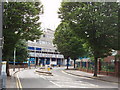
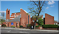
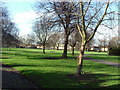
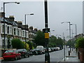
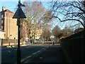
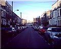
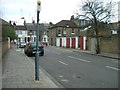
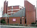
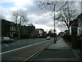
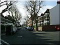
Wormholt Ward occupies a distinctive position within the London Borough of Hammersmith and Fulham, encompassing 64.8 hectares of West London. This electoral ward covers the historic Wormholt and Old Oak estates, originally situated in the Shepherds Bush area. The name itself tells a story of the land's past, deriving from Old English roots for 'snake' and 'wood', hinting at a time when the estate was a snake-infested woodland. By the nineteenth century, the landscape had shifted to include Old Oak Farm and Wormholt Farm, with the latter comprising over 368 acres divided into 32 fields by 1845. The modern history of living in Wormholt Ward began in the early 1900s when the London County Council purchased land to construct substantial housing estates between the two world wars. Today, the area reflects the principles of the Garden City movement, featuring planned suburban characters with tree-lined streets and low-density housing. You are entering a conservation area designated in May 1980, which protects the high-quality external detailing and open settings with privet hedges that define the neighbourhood. Daily life here revolves around a heritage that blends historical significance with functional, purpose-built environments designed specifically for quality public housing. The ward elects two councillors to the local authority, ensuring a direct link between residents and the borough's governance structure.
- Area Type
- District Borough Unitary Ward
- Area Size
- 64.8 hectares
- Population
- Not available
- Population Density
- Not available
Demographics
The community profile in Wormholt Ward reveals a very mature population, with a median age of 70 years. This statistic indicates that the most common age range for residents is significantly older than the national average. When considering who lives in Wormholt Ward, the data shows that age demographics heavily skew towards retirement living or long-term residency rather than a mix of families with young children. Home ownership presents an interesting picture, as only 34% of households own their property outright. This figure suggests that a substantial majority of residents likely live in rental accommodation or are key workers in the area. The ward does not appear to have a high concentration of young families based on the median age alone. For someone interested in homes in Wormholt Ward, the rental market is likely more active than the ownership market. Diversities in ethnic groupings and religious affiliations are present in the ward, yet the overarching demographic narrative is defined by the senior population. The household composition and accommodation types reflect a settled community where many individuals may have resided in their current properties for decades.
Household Size
Accommodation Type
Tenure
Ethnic Group
Religion
Household Composition
Age
Household Deprivation
NS-SEC
Explore more demographic insights in this area
Go to Demographics tabPlanning
Planning Constraints
- Flood RiskPremium
- Ramsar Wetland SitesPremium
- Area of Outstanding Natural BeautyPremium
- Protected Nature ReservePremium
- Protected WoodlandPremium