Area Overview for Woolwich Common Ward
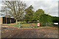
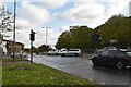
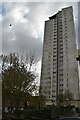
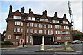
Photos of Woolwich Common Ward
Area Information
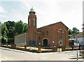
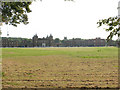
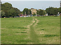
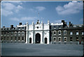
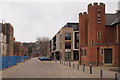
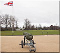
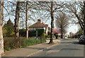
Living in Woolwich Common Ward offers a distinct experience within southeast London. This electoral ward, situated in the Royal Borough of Greenwich, covers an area of 2.1 km². Much of the space is defined by Woolwich Common, a conservation area and urban park that sits on the northern slope of Shooter's Hill. The hill stands at 132 metres high and overlooks the ward. You will find the ward located a few hundred metres southwest of Woolwich town centre. Strategic roads form the boundaries of this district. The A207 Shooters Hill Road runs along the south, while the A205 South Circular and Academy Road define the east. To the west, Repository Road and the Queen Elizabeth Hospital border the area. The north separates the military section from the rest of the ward via Ha-ha Road. Until the mid-18th century, this location was part of a larger open space. Significant infrastructure changes arrived in 1774 with the construction of Royal Artillery Barracks. A ha-ha was installed in 1778 to separate the common land from the barracks. The ward hosted shooting events for the 2012 Olympics and has hosted the London Marathon. The military presence is expected to continue with the King's Troop Royal Horse Artillery retained onsite. You are buying into an area with deep historical roots and clear modern boundaries.
- Area Type
- District Borough Unitary Ward
- Area Size
- 2.1 km²
- Population
- Not available
- Population Density
- Not available
Demographics
The community within Woolwich Common Ward is older than many parts of London. The median age here is 70 years old. This indicates a population skew towards residents in their senior years. Household composition and predominant ethnic group data are recorded in local census totals. Religion statistics are also available as part of the broader demographic profile. Home ownership stands at 26% for the entire ward. This relatively low percentage suggests that rental properties make up the majority of accommodation. The ward population recorded at the 2011 Census was 17,499 people. While specific age ranges are listed generally in the data as total age, the high median age points to a mature demographic. This profile affects local services and the pace of daily life. You will likely encounter a quieter environment compared to neighbouring zones with younger families. The concentration of older residents correlates with the historical development of villas and social housing that replaced earlier structures like Kempt Terrace. Understanding this age distribution is key to knowing who lives in this single ward.
Household Size
Accommodation Type
Tenure
Ethnic Group
Religion
Household Composition
Age
Household Deprivation
NS-SEC
Explore more demographic insights in this area
Go to Demographics tabPlanning
Planning Constraints
- Flood RiskPremium
- Ramsar Wetland SitesPremium
- Area of Outstanding Natural BeautyPremium
- Protected Nature ReservePremium
- Protected WoodlandPremium
- Crime RiskPremium