Area Overview for Woolwich Arsenal Ward
Photos of Woolwich Arsenal Ward


Area Information
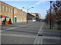
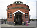
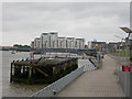
Living in Woolwich Arsenal Ward offers a distinct experience defined by its compact size and high population density. This district constitutes a ward within the Greenwich borough of south east London, covering an area of just 1.2 square kilometres. Despite its small footprint, the locality supports a population of 3,600 residents, resulting in a density of 3,004 people per square kilometre. The concentration of people in such a limited space creates a specific living environment where urban intensity meets the edge of greater greenery. Prospective buyers should understand that daily life here is characterised by close proximity to neighbours within a defined geographical parcel. The area functions as a specific unitary ward, blending residential needs with the broader context of the wider Woolwich region. Understanding these physical boundaries and population concentrations is essential for anyone considering a home here, as the local infrastructure and community dynamics are shaped directly by these metrics.
- Area Type
- District Borough Unitary Ward
- Area Size
- 1.2 km²
- Population
- 3600
- Population Density
- 3004 people/km²
Demographics
The community within Woolwich Arsenal Ward presents a clear demographic profile dominated by an older population. Residents in this ward have a median age of 70 years, indicating that typical households consist of older individuals or couples rather than young families or single professionals. This age distribution shapes the local demand and the type of facilities that serve the area. Home ownership stands at a relatively low level of 29%, suggesting that a significant portion of the population relies on renting their accommodation. This high rental proportion often implies a market where long-term residents may include those supported by housing associations or local councils. The low ownership rate contrasts with the senior demographic, creating a specific economic landscape. Any analysis of households in Woolwich Arsenal Ward must account for these statistical realities, as they influence everything from local spending power to community engagement levels.
Household Size
Accommodation Type
Tenure
Ethnic Group
Religion
Household Composition
Age
Household Deprivation
NS-SEC
Explore more demographic insights in this area
Go to Demographics tabPlanning
Planning Constraints
- Flood RiskPremium
- Ramsar Wetland SitesPremium
- Area of Outstanding Natural BeautyPremium
- Protected Nature ReservePremium
- Protected WoodlandPremium