Area Overview for West Dulwich Ward
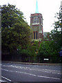
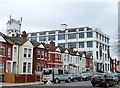
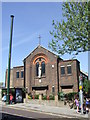
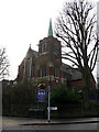
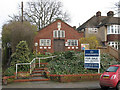
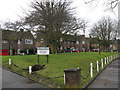
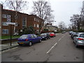
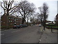
Photos of West Dulwich Ward
Area Information
West Dulwich Ward is a distinct district within the borough of Southwark, covering an area of 1.5 km². Living in this compact space means navigating a locality with a very specific demographic profile, as the resident population has a median age of 70. This figure defines the daily rhythm of the neighbourhood, contrasting sharply with younger urban centres. You will find a community where retirement-aged residents make up the majority demographic rather than families or young professionals. The small geographic footprint suggests a dense, accessible environment where local amenities are likely within walking distance for those with mobility needs. Homes in West Dulwich Ward cater primarily to an older generation, creating a quiet residential atmosphere. The concentration of older people here changes the character of the street compared to surrounding areas of London. When considering what daily life is like, you should anticipate a setting built around retirement rather than employment or heavy commercial activity. The ward offers a rare glimpse into the living arrangements of its senior population, providing a straightforward fact for anyone conducting due diligence before purchasing. There is no ambiguity about the age profile; the data confirms that this is a mature community focused on the needs and demographics of its elderly residents.
- Area Type
- District Borough Unitary Ward
- Area Size
- 1.5 km²
- Population
- Not available
- Population Density
- Not available
Demographics
The community in West Dulwich Ward is defined by its senior demographic, with a median age of 70. This average age indicates that the area is heavily populated by retirees living in the Southwark borough. While specific breakdowns for household composition and predominant ethnic groups are not detailed in current records, the high median age suggests a homogenous retirement environment. Most age data spans the total population, reflecting that the entire ward leans toward this older bracket. Home ownership remains a significant feature here, with 51% of residents owning their property outright. This ownership rate is slightly above the UK average for similar retirement zones, suggesting financial stability among the long-term residents. The rest of the households are likely rentals, though exact figures for household composition remain unlisted in the available dataset. Accommodation types vary across the 1.5 km², but the stock clearly serves an older demographic. Understanding these demographics is vital for anyone considering buying into West Dulwich Ward, as the social fabric revolves around this established age group. The area does not cater to a primarily young family population, and the social dynamics reflect this older makeup.
Household Size
Accommodation Type
Tenure
Ethnic Group
Religion
Household Composition
Age
Household Deprivation
NS-SEC
Explore more demographic insights in this area
Go to Demographics tabPlanning
Planning Constraints
- Flood RiskPremium
- Ramsar Wetland SitesPremium
- Area of Outstanding Natural BeautyPremium
- Protected Nature ReservePremium
- Protected WoodlandPremium
- Crime RiskPremium