Area Overview for Wendell Park Ward
Photos of Wendell Park Ward

Area Information
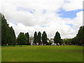
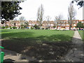
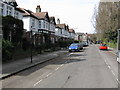
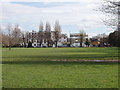
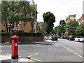
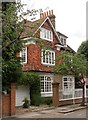
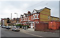
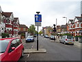
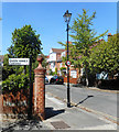
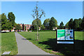
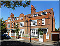
Living in Wendell Park Ward offers a distinctly historic perspective on London life within the London Borough of Hammersmith and Fulham. This electoral ward spans 56.8 hectares and acts as a hub for residents around the 2022 election cycle, electing two council councillors. Your daily experience is centred on landmarks that date back over a century, most notably Wendell Park itself. This green space, located off Askew Road in Shepherd's Bush, features mature trees, central lawns, and formal borders. You can find the park crescent year-round, but the area's soul lies in its educational heritage. Wendell Park Primary School stands as a Queen Anne style building dating from 1900, originally designed by Thomas J. Bailey and formally opened in 1901. The school recently received extensions in the 2010s, blending its historic 1925 renaming with modern facilities. You will also see St Saviour's Church, built in 1890 and opened by Hammersmith Vestry between 1896 and 1897. The Vicarage overlooking the park was constructed in 1894. Houses in this ward, particularly those on Wendell Road ranging from 65 to 103, were built during a transition from orchards to housing terraces following the 1880s. WWII history remains visible in the site of a former air raid shelter within the park boundaries. This mix of religious buildings, educational institutions, and residential terraces defines the character of homes in this specific part of London.
- Area Type
- District Borough Unitary Ward
- Area Size
- 56.8 hectares
- Population
- Not available
- Population Density
- Not available
Demographics
The community in Wendell Park Ward presents a clear demographic profile with a median age of 70. This figure indicates that the population skews heavily towards older residents, suggesting a neighbourhood where life pace may be slower and community interactions revolve around long-term settlements. Only 51% of residents own their homes, which implies a significant portion of the population relies on renting or other living arrangements. While specific data on household composition, predominant ethnic groups, and religion are not available in the current dataset, the age statistics alone paint a picture of an established community. The area encompasses a total population spread across these 56.8 hectares. Without precise household breakdowns, you can infer that the high median age correlates with retirement living or families staying in the area until advanced years. The home ownership rate of just over half suggests a mixed market where investors and tenants play a substantial role alongside owner-occupiers. You cannot rely on vague generalisations about diversity or family size because the explicit figures for those categories are absent from the records. Instead, focus on the defining statistic: the bulk of your neighbours are likely to be seniors. This fact shapes local services, leisure activities, and the general atmosphere of the ward without the need for further speculation.
Household Size
Accommodation Type
Tenure
Ethnic Group
Religion
Household Composition
Age
Household Deprivation
NS-SEC
Explore more demographic insights in this area
Go to Demographics tabPlanning
Planning Constraints
- Flood RiskLocked
- Ramsar Wetland SitesLocked
- Area of Outstanding Natural BeautyLocked
- Protected Nature ReserveLocked
- Protected WoodlandLocked
- Crime RiskLocked