Area Overview for Wandsworth Town Ward
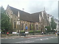
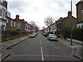
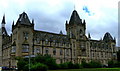
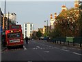
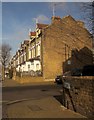
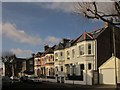
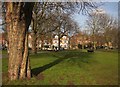
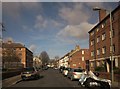
Photos of Wandsworth Town Ward


Area Information
Living in Wandsworth Town Ward offers a compact yet densely populated experience within the London Borough of Wandsworth. This district covers exactly 1.6 km², a small footprint that supports a population of 4,864 residents. The area is defined by its high population density, which reaches 3,086 people per square kilometre. Such concentration suggests a neighbourhood where daily life often involves close proximity to fellow residents. For those considering homes in Wandsworth Town Ward, the sheer volume of people living in such a small space shapes the community dynamic. It is not a sprawling suburb but a tight-knit urban ward where significant time is spent in shared public spaces. The area represents a specific slice of London life where urban intensity meets local convenience. You will find yourself surrounded by others in a setting that balances residential living with the pressures of high occupancy. Understanding these physical boundaries is essential for anyone evaluating whether this location suits their lifestyle needs.
- Area Type
- District Borough Unitary Ward
- Area Size
- 1.6 km²
- Population
- 4864
- Population Density
- 3086 people/km²
Demographics
The community in Wandsworth Town Ward exhibits a unique demographic profile compared to many other urban districts. The median age for residents is 70 years old, indicating a significant portion of the population consists of older adults. Statistical analysis shows that the most common age range is categorised as 'Age: Total', reflecting a broad distribution across varying life stages within this specific ward. Home ownership stands at 41%, meaning slightly less than half of the households have a stake in their accommodation. This figure suggests a mixed environment where rental properties likely outnumber owner-occupied homes. Regarding household composition and accommodation types, the data indicates totals for the ward without breaking down specifics like single-family homes or flats. Ethnic diversity and religious affiliation are recorded as totals for the entire ward, providing an aggregate view of the population's background. These figures paint a picture of an area settled primarily by an older demographic with a moderate level of resident investment in their homes.
Household Size
Accommodation Type
Tenure
Ethnic Group
Religion
Household Composition
Age
Household Deprivation
NS-SEC
Explore more demographic insights in this area
Go to Demographics tabPlanning
Planning Constraints
- Flood RiskPremium
- Ramsar Wetland SitesPremium
- Area of Outstanding Natural BeautyPremium
- Protected Nature ReservePremium
- Protected WoodlandPremium
- Crime RiskPremium