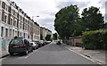
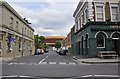
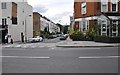
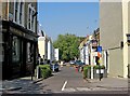
Area Overview for Walham Green Ward
Photos of Walham Green Ward
Area Information
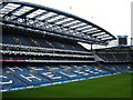
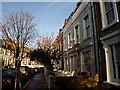
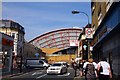
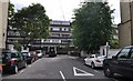
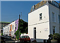
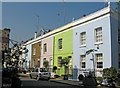
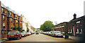
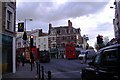
Walham Green Ward is an electoral ward within the London Borough of Hammersmith and Fulham, covering a specific area of 48.2 hectares. This district lies in inner London, situated within the historic parish of Fulham. The location is centred on Fulham Broadway, a major commercial and residential zone that defines the contemporary character of the area. You will find that the ward encompasses the urban centre that developed following the arrival of the District Railway in the 19th century. Today, Fulham Broadway serves as the hub, featuring the former Grade II listed Fulham Town Hall and the tube station that bears the parish's original name. The landscape is defined by a mix of pedestrianised high streets with St John's Church and commercial thoroughfares like North End Road. You can access the historic pedestrianised streets surrounding the 1828-built church, which offer dining and local shops. The area also includes the grounds of Beaufort House, historically significant for hosting the first AAC Championships in 1866. Stamford Bridge, the stadium home to Chelsea Football Club, stands as a key landmark within the ward boundaries. For those interested in local history, the site of the community once hosted a notable brewing industry dating back to 1765. Living in Walham Green Ward means you reside in a densely built, historic urban environment close to the River Thames and Chelsea Harbour.
- Area Type
- District Borough Unitary Ward
- Area Size
- 48.2 hectares
- Population
- Not available
- Population Density
- Not available
Demographics
The community profile within Walham Green Ward reveals a population with a median age of 70. This figure indicates a demographic heavily weighted towards older residents. While the data notes the age range as 'Age: Total', the median age of 70 characterises the ward as an area where mature adults form the core of the population. Regarding housing tenure, only 26% of homes in Walham Green are owner-occupied. This statistic suggests that the majority of the population lives in the private rental market or leases properties rather than holding freehold or leasehold titles. The ward's household composition and accommodation type data are categorised as 'total' in the records, reflecting the broad mix of living arrangements within the 48.2-hectare boundary. You should be aware that the area does not show data on specific ethnic groups or religious affiliations in the provided statistics, meaning the community appears diverse but unquantified by these specific metrics in current reports. The high ownership rate is actually low at 26%, which contrasts with many wealthy London suburbs. This lower figure for home ownership implies that many young professionals and Chelsea overflow residents likely rent rather than buy in this specific ward. Consequently, the cost to buy a home here presents different challenges compared to areas with higher owner-occupation rates.
Household Size
Accommodation Type
Tenure
Ethnic Group
Religion
Household Composition
Age
Household Deprivation
NS-SEC
Explore more demographic insights in this area
Go to Demographics tabPlanning
Planning Constraints
- Flood RiskLocked
- Ramsar Wetland SitesLocked
- Area of Outstanding Natural BeautyLocked
- Protected Nature ReserveLocked
- Protected WoodlandLocked
- Crime RiskLocked