Area Overview for W9 3BD
Photos of W9 3BD
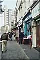
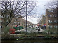


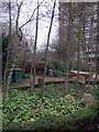
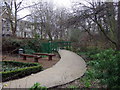

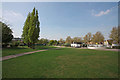

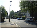
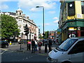
100 photos from this area
Area Information
Key information about the W9 3BD including its size, population, and administrative classification.
- Area Type
- Postcode
- Area Size
- 4495 m²
- Population
- 1859
- Population Density
- 25156 people/km²
House Prices in W9 3BD
58
Properties
£522,031
Average Sold Price
£226,750
Lowest Price
£830,000
Highest Price
Showing 58 properties
| Address | Type | Beds | Baths | Last Sale Price | Last Sale Date | |
|---|---|---|---|---|---|---|
| 2L Portnall Road, London, W9 3BD | Flat | 2 | 1 | £830,000 | Oct 2024 | |
| 2A PORTNALL ROAD, London, W9 3BD | Flat | - | - | £374,500 | Apr 2024 | |
| 44B Portnall Road, London, W9 3BD | Flat | - | - | £555,000 | Apr 2023 | |
| 30A Portnall Road, London, W9 3BD | Flat | 3 | 2 | £687,500 | Feb 2021 | |
| 6B Portnall Road, London, W9 3BD | Flat | 2 | 1 | £525,000 | Jan 2018 | |
| 6A Portnall Road, London, W9 3BD | Flat | - | - | £737,500 | Jan 2016 | |
| 40B Portnall Road, London, W9 3BD | Flat | - | - | £240,000 | Dec 2009 | |
| 30B Portnall Road, London, W9 3BD | Flat | 2 | 1 | £226,750 | Oct 2004 | |
| Ground Floor Flat 2C, 2A Portnall Road, London, W9 3BD | Flat | 3 | 2 | - | - | |
| 28B Portnall Road, London, W9 3BD | Maisonette | 2 | 1 | - | - |
Page 1 of 6
Energy Efficiency in W9 3BD
Amenities
Schools
| Rank | School | Type | Entry gender | Ages |
|---|
Explore more schools in this area
Go to Schools tabDemographics
Household Size
One person
most common
Accommodation Type
Flats
most common
Tenure
24
majority
Ethnic Group
White
most common
Religion
N/A
most common
Household Composition
N/A
most common
Age
47
median
Adults (30-64 years)
most common
Household Deprivation
N/A
with no deprivation
NS-SEC
32
in Lower managerial occupations
Explore more demographic insights in this area
Go to Demographics tabPlanning
Planning Constraints
- Flood RiskPremium
- Ramsar Wetland SitesPremium
- Area of Outstanding Natural BeautyPremium
- Protected Nature ReservePremium
- Protected WoodlandPremium