Area Overview for W8 7AX
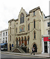
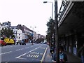
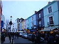
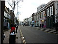
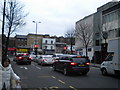
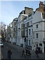
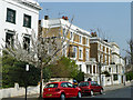
Photos of W8 7AX


Area Information
W8 7AX occupies a compact footprint of 3,353 square metres in central England, a designation that covers a small residential cluster rather than a sprawling district. This dense concentration means living in W8 7AX implies navigating an urban environment where every square kilometre houses 354,618 people across the recording zone. The population stands at 1,189 individuals, creating a high density characteristic of specific London postcode sectors. Residents experience a locality defined by its concentration rather than broad geographic spread. Daily life here is shaped by the immediate proximity to major transport nodes like Notting Hill Gate Station and Kensington Station without extending into outlying suburbs. The area functions as a node within a larger metropolitan grid, offering immediate access to services while maintaining a defined residential boundary. Prospective buyers view W8 7AX as a specific entry point into a high-demand corridor where housing stock is restricted by the small physical area. You must expect a environment where proximity defines convenience and where the residential cluster sits directly alongside major commercial and transport infrastructure. The location offers immediate reach to the wider West London network while remaining a distinct postcode area with its own demographic character.
- Area Type
- Postcode
- Area Size
- 3353 m²
- Population
- 1189
- Population Density
- 12373 people/km²
Homes in W8 7AX exist within a tightly constrained physical boundary of just 3,353 square metres, limiting the total volume of available stock. The market is characterised by flats as the predominant accommodation type, which is typical for postcodes in central London with extreme population density figures. This specific housing stock shifts the market focus towards rental dynamics and investment properties rather than large family homes. With only 43 per cent of residents owning their homes, the area presents a balanced profile where speculative investment and private renting remain significant factors. Buyers looking at this small area should expect a supply of units concentrated in vertical developments rather than sprawling suburban developments. The small area size of 0.003 square kilometres means competition for available flats can be intense given the high demand for central London residences. You will find that most transactions involve one or two bedroom units suitable for young professionals or investors seeking yields from a high-density location. The property market in W8 7AX reflects the broader trends of the immediate surroundings, where flats dominate the landscape and ownership rates moderate between the extremes of stark rental markets or exclusive owner-occupied estates.
House Prices in W8 7AX
Showing 65 properties
| Address | Type | Beds | Baths | Last Sale Price | Last Sale Date | |
|---|---|---|---|---|---|---|
| 21 Campden Hill Gardens, London, W8 7AX | Semi-detached | 6 | 5 | £2,700,000 | Jul 2005 | |
| Flat 1, 15 Campden Hill Gardens, London, W8 7AX | Flat | 2 | 2 | - | - | |
| Flat 4, 13 Campden Hill Gardens, London, W8 7AX | Flat | 1 | 1 | - | - | |
| Flat 3, 5 Campden Hill Gardens, London, W8 7AX | Flat | 1 | 1 | - | - | |
| Flat 2, 7 Campden Hill Gardens, London, W8 7AX | Flat | 1 | 1 | - | - | |
| Flat 4, 9 Campden Hill Gardens, London, W8 7AX | Flat | 1 | 1 | - | - | |
| Flat 9, 9 Campden Hill Gardens, London, W8 7AX | Flat | 2 | 1 | - | - | |
| Flat 2, 25 Campden Hill Gardens, London, W8 7AX | Maisonette | 2 | 2 | - | - | |
| Flat 4, 5 Campden Hill Gardens, London, W8 7AX | Flat | 3 | 2 | - | - | |
| Flat 2, 15 Campden Hill Gardens, London, W8 7AX | Flat | 3 | 3 | - | - |
Energy Efficiency in W8 7AX
Living in W8 7AX grants immediate access to a dense network of retail and transport options despite the small area size. Waitrose Little Waitrose, Tesco Notting, and M&S Notting Hill Gate SF dominate the local retail scene, providing high-quality shopping within practical reach. The metro network is exceptional, with Notting Hill Gate Station, Holland Park, and Queensway Station located nearby for rapid connections. Rail travellers benefit from Kensington Station, Shepherd's Bush Railway Station, and Paddington Station within the immediate vicinity. Water travel is also viable via Little Venice Waterbus Stop, Cadogan Pier, and Chelsea Harbour Pier. Bus connections link London Victoria Coach Station Arrivals, Victoria Coach Station, and Green Line Coach Station to the doorstep. You can walk to multiple transport hubs or complete shopping errands without needing extensive travel time. This convenience defines daily life here, where amenities cluster tightly around the residential cluster. The presence of these specific venues ensures that practical necessities and leisure activities remain accessible without travel delays.
Amenities
Schools
| Rank | School | Type | Entry gender | Ages |
|---|
Explore more schools in this area
Go to Schools tabDemographics
The community in W8 7AX is defined by a mature household profile with a median age of 47. Adults aged between 30 and 64 years represent the most common age range, indicating a stable population of working-age individuals and older professionals. Home ownership accounts for 43 per cent of households, suggesting a balanced market where significant portions of residents rent their properties. This mix influences the social fabric and purchasing power within the small residential cluster. The accommodation type assessment identifies flats as the predominant housing form, aligning with the high-density landscape of 3,353 square metres. Beyond age and ownership, the predominant ethnic group is White, reflecting the broader demographic composition of the immediate surrounding neighbourhoods. These figures describe a community where homes in W8 7AX serve a mix of owner-occupiers and residents in multi-storey developments. The demographic data points to a diverse yet settled population navigating a high-density urban setting. You will find a community where professional and middle-income groups likely dominate, given the central location and flat-based housing stock typical of this postcode sector.
Household Size
Accommodation Type
Tenure
Ethnic Group
Religion
Household Composition
Age
Household Deprivation
NS-SEC
Explore more demographic insights in this area
Go to Demographics tabPlanning
Planning Constraints
- Flood RiskPremium
- Ramsar Wetland SitesPremium
- Area of Outstanding Natural BeautyPremium
- Protected Nature ReservePremium
- Protected WoodlandPremium