Area Overview for W7 2JR
Photos of W7 2JR
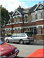
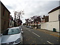
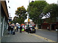
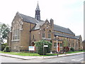

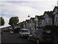
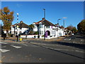
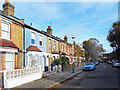
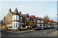
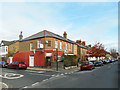
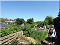
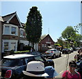
65 photos from this area
Area Information
Key information about the W7 2JR including its size, population, and administrative classification.
- Area Type
- Postcode
- Area Size
- 7240 m²
- Population
- 1755
- Population Density
- 15169 people/km²
House Prices in W7 2JR
35
Properties
£569,043
Average Sold Price
£249,000
Lowest Price
£1,050,000
Highest Price
Showing 35 properties
| Address | Type | Beds | Baths | Last Sale Price | Last Sale Date | |
|---|---|---|---|---|---|---|
| 32 Seward Road, Hanwell, W7 2JR | Semi-detached | 5 | 3 | £1,050,000 | Mar 2023 | |
| 2A Seward Road, Hanwell, W7 2JR | Flat | - | - | £500,000 | Dec 2022 | |
| 2 Seward Road, Hanwell, W7 2JR | Flat | 1 | - | £290,000 | Dec 2022 | |
| 36 Seward Road, Hanwell, W7 2JR | Semi-detached | 3 | 2 | £820,000 | Aug 2022 | |
| 44 Seward Road, Hanwell, W7 2JR | house | - | - | £970,000 | Jun 2022 | |
| 48 Seward Road, Hanwell, W7 2JR | house | 5 | 2 | £880,000 | Mar 2020 | |
| 22 Seward Road, Hanwell, W7 2JR | Semi-detached | 5 | - | £940,000 | Jul 2019 | |
| 50 Seward Road, Hanwell, W7 2JR | Semi-detached | 3 | 2 | £795,000 | Dec 2017 | |
| 30 Seward Road, Hanwell, W7 2JR | Semi-detached | 3 | 1 | £783,000 | Nov 2017 | |
| 20 Seward Road, Hanwell, W7 2JR | house | 3 | - | £790,000 | Aug 2014 |
Page 1 of 4
Energy Efficiency in W7 2JR
Amenities
Schools
| Rank | School | Type | Entry gender | Ages |
|---|
Explore more schools in this area
Go to Schools tabDemographics
Household Size
Family (3-5 people)
most common
Accommodation Type
Houses
most common
Tenure
65
majority
Ethnic Group
White
most common
Religion
N/A
most common
Household Composition
N/A
most common
Age
47
median
Adults (30-64 years)
most common
Household Deprivation
N/A
with no deprivation
NS-SEC
49
in Lower managerial occupations
Explore more demographic insights in this area
Go to Demographics tabPlanning
Planning Constraints
- Flood RiskPremium
- Ramsar Wetland SitesPremium
- Area of Outstanding Natural BeautyPremium
- Protected Nature ReservePremium
- Protected WoodlandPremium