Area Overview for W7 2JD
Photos of W7 2JD
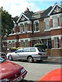
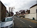
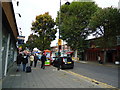
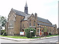

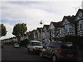
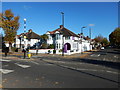
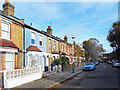
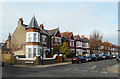
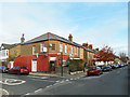
65 photos from this area
Area Information
Key information about the W7 2JD including its size, population, and administrative classification.
- Area Type
- Postcode
- Area Size
- 3323 m²
- Population
- 1728
- Population Density
- 11467 people/km²
House Prices in W7 2JD
22
Properties
£453,425
Average Sold Price
£72,600
Lowest Price
£795,000
Highest Price
Showing 22 properties
| Address | Type | Beds | Baths | Last Sale Price | Last Sale Date | |
|---|---|---|---|---|---|---|
| 92A Elthorne Park Road, Hanwell, W7 2JD | Flat | 3 | 2 | £575,000 | Oct 2024 | |
| 76 Elthorne Park Road, Hanwell, W7 2JD | Terraced | 3 | 2 | £695,000 | Apr 2023 | |
| 78 Elthorne Park Road, Hanwell, W7 2JD | house | - | - | £715,000 | Sep 2021 | |
| 86 Elthorne Park Road, Hanwell, W7 2JD | Terraced | 3 | 2 | £795,000 | Jun 2017 | |
| 84 Elthorne Park Road, Hanwell, W7 2JD | house | - | - | £652,000 | Dec 2015 | |
| 54 Elthorne Park Road, Hanwell, W7 2JD | Terraced | 4 | - | £580,000 | Jul 2013 | |
| 74A Elthorne Park Road, Hanwell, W7 2JD | Flat | 1 | 1 | £218,000 | Dec 2010 | |
| 56 Elthorne Park Road, Hanwell, W7 2JD | Terraced | - | - | £420,000 | Apr 2007 | |
| 88 Elthorne Park Road, Hanwell, W7 2JD | Terraced | - | - | £423,500 | Jun 2006 | |
| 90 Elthorne Park Road, Hanwell, W7 2JD | house | 1 | - | £183,000 | Aug 1999 |
Page 1 of 3
Energy Efficiency in W7 2JD
Amenities
Schools
| Rank | School | Type | Entry gender | Ages |
|---|
Explore more schools in this area
Go to Schools tabDemographics
Household Size
Family (3-5 people)
most common
Accommodation Type
Houses
most common
Tenure
81
majority
Ethnic Group
White
most common
Religion
N/A
most common
Household Composition
N/A
most common
Age
47
median
Adults (30-64 years)
most common
Household Deprivation
N/A
with no deprivation
NS-SEC
52
in Lower managerial occupations
Explore more demographic insights in this area
Go to Demographics tabPlanning
Planning Constraints
- Flood RiskPremium
- Ramsar Wetland SitesPremium
- Area of Outstanding Natural BeautyPremium
- Protected Nature ReservePremium
- Protected WoodlandPremium