Area Overview for W7 1AB
Photos of W7 1AB
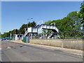
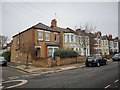
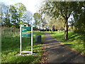
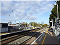
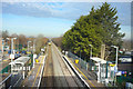
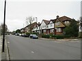
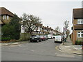
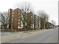
48 photos from this area
Area Information
Key information about the W7 1AB including its size, population, and administrative classification.
- Area Type
- Postcode
- Area Size
- 4590 m²
- Population
- 1769
- Population Density
- 8297 people/km²
House Prices in W7 1AB
16
Properties
£370,875
Average Sold Price
£190,000
Lowest Price
£515,000
Highest Price
Showing 16 properties
| Address | Type | Beds | Baths | Last Sale Price | Last Sale Date | |
|---|---|---|---|---|---|---|
| 12 Hall Drive, Hanwell, W7 1AB | Terraced | 2 | 1 | £497,000 | Feb 2025 | |
| 14 Hall Drive, Hanwell, W7 1AB | Terraced | 2 | 1 | £448,000 | Mar 2024 | |
| 11 Hall Drive, Hanwell, W7 1AB | Terraced | 2 | 1 | £515,000 | Jan 2023 | |
| 1 Hall Drive, Hanwell, W7 1AB | house | - | - | £450,000 | Apr 2021 | |
| 7 Hall Drive, Hanwell, W7 1AB | house | - | - | £435,000 | Jul 2017 | |
| 4 Hall Drive, Hanwell, W7 1AB | Terraced | 2 | - | £240,000 | Jul 2013 | |
| 2 Hall Drive, Hanwell, W7 1AB | Terraced | 2 | 1 | £190,000 | Jun 2009 | |
| 5 Hall Drive, Hanwell, W7 1AB | house | - | - | £192,000 | Mar 2004 | |
| 16 Hall Drive, Hanwell, W7 1AB | Terraced | 2 | - | - | - | |
| 3 Hall Drive, Hanwell, W7 1AB | house | - | - | - | - |
Page 1 of 2
Energy Efficiency in W7 1AB
Amenities
Schools
| Rank | School | Type | Entry gender | Ages |
|---|
Explore more schools in this area
Go to Schools tabDemographics
Household Size
Family (3-5 people)
most common
Accommodation Type
Houses
most common
Tenure
52
majority
Ethnic Group
White
most common
Religion
N/A
most common
Household Composition
N/A
most common
Age
47
median
Adults (30-64 years)
most common
Household Deprivation
N/A
with no deprivation
NS-SEC
28
in Lower managerial occupations
Explore more demographic insights in this area
Go to Demographics tabPlanning
Planning Constraints
- Flood RiskPremium
- Ramsar Wetland SitesPremium
- Area of Outstanding Natural BeautyPremium
- Protected Nature ReservePremium
- Protected WoodlandPremium