Area Overview for W6 9LE
Photos of W6 9LE


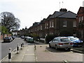
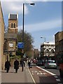
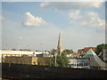


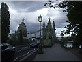

100 photos from this area
Area Information
Key information about the W6 9LE including its size, population, and administrative classification.
- Area Type
- Postcode
- Area Size
- 9136 m²
- Population
- 1374
- Population Density
- 8763 people/km²
House Prices in W6 9LE
55
Properties
£256,535
Average Sold Price
£152,000
Lowest Price
£375,000
Highest Price
Showing 55 properties
| Address | Type | Beds | Baths | Last Sale Price | Last Sale Date | |
|---|---|---|---|---|---|---|
| 42 Riverside Gardens, London, W6 9LE | Flat | - | - | £375,000 | Oct 2021 | |
| 10 Riverside Gardens, London, W6 9LE | Flat | - | - | £292,850 | Jan 2018 | |
| 45 Riverside Gardens, London, W6 9LE | Flat | - | - | £375,000 | Apr 2015 | |
| 23 Riverside Gardens, London, W6 9LE | Flat | 1 | 1 | £250,000 | Sep 2014 | |
| 18 Riverside Gardens, London, W6 9LE | Flat | - | - | £230,000 | Nov 2010 | |
| 2 Riverside Gardens, London, W6 9LE | Flat | - | - | £270,000 | Apr 2010 | |
| 36 Riverside Gardens, London, W6 9LE | Flat | 2 | 1 | £235,000 | Oct 2008 | |
| 6 Riverside Gardens, London, W6 9LE | Flat | - | - | £180,500 | Jan 2008 | |
| 52 Riverside Gardens, London, W6 9LE | Flat | - | - | £205,000 | Sep 2005 | |
| 47 Riverside Gardens, London, W6 9LE | Flat | 2 | 1 | £152,000 | Sep 2001 |
Page 1 of 6
Energy Efficiency in W6 9LE
Amenities
Schools
| Rank | School | Type | Entry gender | Ages |
|---|
Explore more schools in this area
Go to Schools tabDemographics
Household Size
One person
most common
Accommodation Type
Flats
most common
Tenure
23
majority
Ethnic Group
White
most common
Religion
N/A
most common
Household Composition
N/A
most common
Age
47
median
Adults (30-64 years)
most common
Household Deprivation
N/A
with no deprivation
NS-SEC
44
in Lower managerial occupations
Explore more demographic insights in this area
Go to Demographics tabPlanning
Planning Constraints
- Flood RiskPremium
- Ramsar Wetland SitesPremium
- Area of Outstanding Natural BeautyPremium
- Protected Nature ReservePremium
- Protected WoodlandPremium