Area Overview for W6 9BD
Photos of W6 9BD

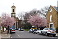

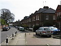
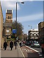
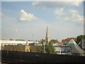

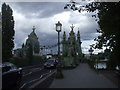
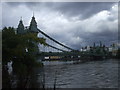
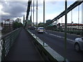
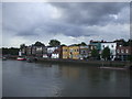
100 photos from this area
Area Information
Key information about the W6 9BD including its size, population, and administrative classification.
- Area Type
- Postcode
- Area Size
- 5505 m²
- Population
- 1496
- Population Density
- 8202 people/km²
House Prices in W6 9BD
20
Properties
£514,094
Average Sold Price
£97,000
Lowest Price
£1,325,000
Highest Price
Showing 20 properties
| Address | Type | Beds | Baths | Last Sale Price | Last Sale Date | |
|---|---|---|---|---|---|---|
| 18 St Peters Road, London, W6 9BD | Semi-detached | 3 | 2 | £1,325,000 | May 2022 | |
| 30 St Peters Road, London, W6 9BD | Semi-detached | 3 | - | £968,750 | Jan 2017 | |
| 4 St Peters Road, London, W6 9BD | house | - | - | £435,000 | May 2005 | |
| 2A St Peters Road, London, W6 9BD | Maisonette | - | - | £375,000 | Nov 2003 | |
| 26 St Peters Road, London, W6 9BD | Semi-detached | - | - | £412,000 | Sep 2002 | |
| 24 St Peters Road, London, W6 9BD | Semi-detached | - | - | £345,000 | Jun 2002 | |
| 34 St Peters Road, London, W6 9BD | Flat | 2 | - | £97,000 | Sep 1997 | |
| 22 St Peters Road, London, W6 9BD | Semi-detached | - | - | £155,000 | Nov 1996 | |
| Flat 1, Hope House, 40 St Peters Road, London, W6 9BD | Semi-detached | 2 | 1 | - | - | |
| 16 St Peters Road, London, W6 9BD | Terraced | 2 | 1 | - | - |
Page 1 of 2
Energy Efficiency in W6 9BD
Amenities
Schools
| Rank | School | Type | Entry gender | Ages |
|---|
Explore more schools in this area
Go to Schools tabDemographics
Household Size
One person
most common
Accommodation Type
Flats
most common
Tenure
48
majority
Ethnic Group
White
most common
Religion
N/A
most common
Household Composition
N/A
most common
Age
47
median
Adults (30-64 years)
most common
Household Deprivation
N/A
with no deprivation
NS-SEC
52
in Lower managerial occupations
Explore more demographic insights in this area
Go to Demographics tabPlanning
Planning Constraints
- Flood RiskPremium
- Ramsar Wetland SitesPremium
- Area of Outstanding Natural BeautyPremium
- Protected Nature ReservePremium
- Protected WoodlandPremium