Area Overview for W6 7NL
Photos of W6 7NL
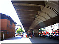
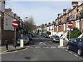
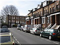
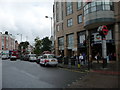
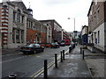
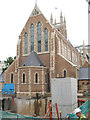
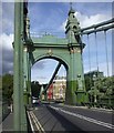
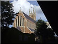
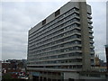
100 photos from this area
Area Information
Key information about the W6 7NL including its size, population, and administrative classification.
- Area Type
- Postcode
- Area Size
- 2.4 hectares
- Population
- 1353
- Population Density
- 5822 people/km²
House Prices in W6 7NL
100
Properties
-
Average Sold Price
-
Lowest Price
-
Highest Price
Showing 100 properties (first 250)
| Address | Type | Beds | Baths | Last Sale Price | Last Sale Date | |
|---|---|---|---|---|---|---|
| 230 Shepherds Bush Road, London, W6 7NL | Flat | 2 | 1 | - | - | |
| Room C539, 230 Shepherds Bush Road, London, W6 7NL | studentAccommodation | - | - | - | - | |
| 222 Shepherds Bush Road, London, W6 7NL | Office | - | - | - | - | |
| Draft House, 238 Shepherds Bush Road, London, W6 7NL | restaurant_cafe | - | - | - | - | |
| 220 Shepherds Bush Road, London, W6 7NL | Restaurant | - | - | - | - | |
| Avenue House, 214-218 Shepherds Bush Road, London, W6 7NL | Office | - | - | - | - | |
| First Floor Offices, 184 Shepherds Bush Road, London, W6 7NL | Office | - | - | - | - | |
| Telephone Box On The Corner Outside, 190 Shepherds Bush Road, London, W6 7NL | commercial | - | - | - | - | |
| Part First Floor Offices, 184 Shepherds Bush Road, London, W6 7NL | Office | - | - | - | - | |
| Part Second Floor Offices, 184 Shepherds Bush Road, London, W6 7NL | Office | - | - | - | - |
Page 1 of 10
Energy Efficiency in W6 7NL
Amenities
Schools
| Rank | School | Type | Entry gender | Ages |
|---|
Explore more schools in this area
Go to Schools tabDemographics
Household Size
One person
most common
Accommodation Type
Flats
most common
Tenure
43
majority
Ethnic Group
White
most common
Religion
N/A
most common
Household Composition
N/A
most common
Age
47
median
Adults (30-64 years)
most common
Household Deprivation
N/A
with no deprivation
NS-SEC
57
in Lower managerial occupations
Explore more demographic insights in this area
Go to Demographics tabPlanning
Planning Constraints
- Flood RiskPremium
- Ramsar Wetland SitesPremium
- Area of Outstanding Natural BeautyPremium
- Protected Nature ReservePremium
- Protected WoodlandPremium