Area Overview for W6 7BL
Photos of W6 7BL
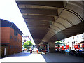
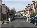
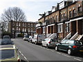
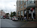


100 photos from this area
Area Information
Key information about the W6 7BL including its size, population, and administrative classification.
- Area Type
- Postcode
- Area Size
- 1.8 hectares
- Population
- 1353
- Population Density
- 5822 people/km²
House Prices in W6 7BL
46
Properties
£3,024,046
Average Sold Price
£707,500
Lowest Price
£8,750,000
Highest Price
Showing 46 properties
| Address | Type | Beds | Baths | Last Sale Price | Last Sale Date | |
|---|---|---|---|---|---|---|
| 14 Brook Green, London, W6 7BL | Terraced | 1 | 1 | £8,750,000 | May 2022 | |
| 21 Brook Green, London, W6 7BL | Terraced | 6 | 3 | £4,000,000 | Sep 2021 | |
| 39 Brook Green, London, W6 7BL | Semi-detached | 5 | 2 | £2,675,000 | Dec 2019 | |
| 16 Brook Green, London, W6 7BL | Terraced | 5 | 2 | £2,850,000 | Jul 2019 | |
| 27 Brook Green, London, W6 7BL | house | - | - | £3,650,000 | Dec 2017 | |
| 19 Brook Green, London, W6 7BL | house | - | - | £3,205,001 | Feb 2010 | |
| 32 Brook Green, London, W6 7BL | house | - | - | £2,351,000 | Sep 2009 | |
| 36 Brook Green, London, W6 7BL | Terraced | - | - | £2,301,000 | Aug 2006 | |
| 37 Brook Green, London, W6 7BL | Terraced | - | - | £1,400,000 | Oct 2003 | |
| 35 Brook Green, London, W6 7BL | Terraced | - | - | £1,375,000 | Apr 2002 |
Page 1 of 5
Energy Efficiency in W6 7BL
Amenities
Schools
| Rank | School | Type | Entry gender | Ages |
|---|
Explore more schools in this area
Go to Schools tabDemographics
Household Size
One person
most common
Accommodation Type
Flats
most common
Tenure
43
majority
Ethnic Group
White
most common
Religion
N/A
most common
Household Composition
N/A
most common
Age
47
median
Adults (30-64 years)
most common
Household Deprivation
N/A
with no deprivation
NS-SEC
57
in Lower managerial occupations
Explore more demographic insights in this area
Go to Demographics tabPlanning
Planning Constraints
- Flood RiskPremium
- Ramsar Wetland SitesPremium
- Area of Outstanding Natural BeautyPremium
- Protected Nature ReservePremium
- Protected WoodlandPremium