Area Overview for W6 0ET
Photos of W6 0ET

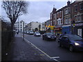
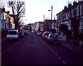
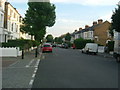
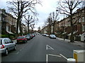
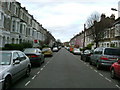
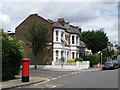
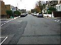

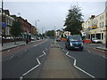
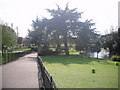
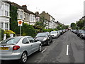
100 photos from this area
Area Information
Key information about the W6 0ET including its size, population, and administrative classification.
- Area Type
- Postcode
- Area Size
- 4098 m²
- Population
- 1806
- Population Density
- 9637 people/km²
House Prices in W6 0ET
21
Properties
£1,648,750
Average Sold Price
£1,000,000
Lowest Price
£2,800,000
Highest Price
Showing 21 properties
| Address | Type | Beds | Baths | Last Sale Price | Last Sale Date | |
|---|---|---|---|---|---|---|
| 141 Dalling Road, London, W6 0ET | Detached | 3 | 2 | £2,800,000 | Jul 2025 | |
| 149 Dalling Road, London, W6 0ET | house | 5 | - | £1,655,000 | Jan 2022 | |
| 143 Dalling Road, London, W6 0ET | Terraced | 5 | 3 | £1,810,000 | Aug 2021 | |
| 137 Dalling Road, London, W6 0ET | Semi-detached | 5 | - | £1,400,000 | Oct 2019 | |
| 127 Dalling Road, London, W6 0ET | Maisonette | 1 | 1 | £1,700,000 | Apr 2019 | |
| 129 Dalling Road, London, W6 0ET | Terraced | 4 | 3 | £1,500,000 | Apr 2019 | |
| 133 Dalling Road, London, W6 0ET | Terraced | 4 | 3 | £1,325,000 | Jul 2013 | |
| 145 Dalling Road, London, W6 0ET | Terraced | 5 | - | £1,000,000 | May 2010 | |
| 139 Dalling Road, London, W6 0ET | Semi-detached | 5 | - | - | - | |
| Flat First Floor, 125 Dalling Road, London, W6 0ET | Flat | - | - | - | - |
Page 1 of 3
Energy Efficiency in W6 0ET
Amenities
Schools
| Rank | School | Type | Entry gender | Ages |
|---|
Explore more schools in this area
Go to Schools tabDemographics
Household Size
Family (3-5 people)
most common
Accommodation Type
Flats
most common
Tenure
42
majority
Ethnic Group
White
most common
Religion
N/A
most common
Household Composition
N/A
most common
Age
47
median
Adults (30-64 years)
most common
Household Deprivation
N/A
with no deprivation
NS-SEC
46
in Lower managerial occupations
Explore more demographic insights in this area
Go to Demographics tabPlanning
Planning Constraints
- Flood RiskPremium
- Ramsar Wetland SitesPremium
- Area of Outstanding Natural BeautyPremium
- Protected Nature ReservePremium
- Protected WoodlandPremium