Area Overview for W6 0DN
Photos of W6 0DN


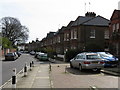
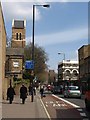


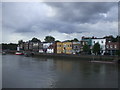
100 photos from this area
Area Information
Key information about the W6 0DN including its size, population, and administrative classification.
- Area Type
- Postcode
- Area Size
- 4481 m²
- Population
- 1599
- Population Density
- 12843 people/km²
House Prices in W6 0DN
63
Properties
£569,495
Average Sold Price
£54,000
Lowest Price
£965,000
Highest Price
Showing 63 properties
| Address | Type | Beds | Baths | Last Sale Price | Last Sale Date | |
|---|---|---|---|---|---|---|
| 45 Banim Street, London, W6 0DN | Terraced | 3 | 2 | £965,000 | May 2021 | |
| 67 Banim Street, London, W6 0DN | house | 2 | - | £812,000 | Apr 2021 | |
| 43 Banim Street, London, W6 0DN | house | - | - | £840,000 | Apr 2021 | |
| 55 Banim Street, London, W6 0DN | house | - | - | £780,000 | Sep 2020 | |
| 47 Banim Street, London, W6 0DN | Terraced | 3 | 2 | £780,000 | Jul 2014 | |
| 53 Banim Street, London, W6 0DN | Terraced | 2 | 1 | £693,500 | Oct 2013 | |
| 77 Banim Street, London, W6 0DN | Terraced | 2 | 1 | £684,000 | Sep 2013 | |
| Flat 7, Anns House, 7 Banim Street, London, W6 0DN | Flat | - | - | £188,000 | Mar 2004 | |
| 51 Banim Street, London, W6 0DN | house | 2 | - | £288,000 | Apr 2003 | |
| 33 Banim Street, London, W6 0DN | Terraced | - | - | £179,950 | Apr 1998 |
Page 1 of 7
Energy Efficiency in W6 0DN
Amenities
Schools
| Rank | School | Type | Entry gender | Ages |
|---|
Explore more schools in this area
Go to Schools tabDemographics
Household Size
One person
most common
Accommodation Type
Flats
most common
Tenure
16
majority
Ethnic Group
White
most common
Religion
N/A
most common
Household Composition
N/A
most common
Age
47
median
Adults (30-64 years)
most common
Household Deprivation
N/A
with no deprivation
NS-SEC
38
in Lower managerial occupations
Explore more demographic insights in this area
Go to Demographics tabPlanning
Planning Constraints
- Flood RiskPremium
- Ramsar Wetland SitesPremium
- Area of Outstanding Natural BeautyPremium
- Protected Nature ReservePremium
- Protected WoodlandPremium