Area Overview for W6 0BG
Photos of W6 0BG
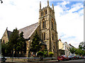
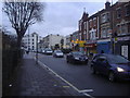
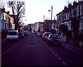
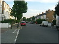
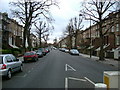
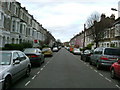
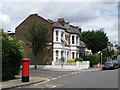
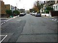

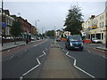
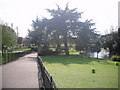
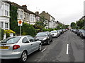
100 photos from this area
Area Information
Key information about the W6 0BG including its size, population, and administrative classification.
- Area Type
- Postcode
- Area Size
- 3873 m²
- Population
- 1458
- Population Density
- 16778 people/km²
House Prices in W6 0BG
48
Properties
£1,232,167
Average Sold Price
£612,000
Lowest Price
£1,925,000
Highest Price
Showing 48 properties
| Address | Type | Beds | Baths | Last Sale Price | Last Sale Date | |
|---|---|---|---|---|---|---|
| 47 Brackenbury Road, London, W6 0BG | Terraced | 3 | 1 | £1,925,000 | May 2025 | |
| 63 Brackenbury Road, London, W6 0BG | Terraced | 4 | 2 | £1,240,000 | May 2020 | |
| 41 Brackenbury Road, London, W6 0BG | Terraced | 5 | - | £1,540,000 | Dec 2014 | |
| 61 Brackenbury Road, London, W6 0BG | Detached | 4 | 3 | £1,426,000 | Aug 2013 | |
| 75 Brackenbury Road, London, W6 0BG | Terraced | - | - | £650,000 | Jun 2004 | |
| 65 Brackenbury Road, London, W6 0BG | Terraced | - | - | £612,000 | Feb 2003 | |
| Flat Second Floor, 67 Brackenbury Road, London, W6 0BG | Flat | 2 | 1 | - | - | |
| 73 Brackenbury Road, London, W6 0BG | Terraced | 5 | 2 | - | - | |
| 69 Brackenbury Road, London, W6 0BG | Terraced | 4 | - | - | - | |
| Flat A Basement, 41 Brackenbury Road, London, W6 0BG | Flat | - | - | - | - |
Page 1 of 5
Energy Efficiency in W6 0BG
Amenities
Schools
| Rank | School | Type | Entry gender | Ages |
|---|
Explore more schools in this area
Go to Schools tabDemographics
Household Size
One person
most common
Accommodation Type
Flats
most common
Tenure
39
majority
Ethnic Group
White
most common
Religion
N/A
most common
Household Composition
N/A
most common
Age
47
median
Adults (30-64 years)
most common
Household Deprivation
N/A
with no deprivation
NS-SEC
50
in Lower managerial occupations
Explore more demographic insights in this area
Go to Demographics tabPlanning
Planning Constraints
- Flood RiskPremium
- Ramsar Wetland SitesPremium
- Area of Outstanding Natural BeautyPremium
- Protected Nature ReservePremium
- Protected WoodlandPremium