Area Overview for W5 5NW
Photos of W5 5NW

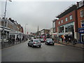

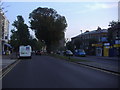
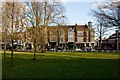
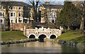

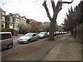

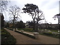
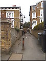
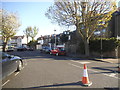
100 photos from this area
Area Information
Key information about the W5 5NW including its size, population, and administrative classification.
- Area Type
- Postcode
- Area Size
- 8151 m²
- Population
- 1370
- Population Density
- 7158 people/km²
House Prices in W5 5NW
40
Properties
£759,464
Average Sold Price
£225,000
Lowest Price
£1,850,000
Highest Price
Showing 40 properties
| Address | Type | Beds | Baths | Last Sale Price | Last Sale Date | |
|---|---|---|---|---|---|---|
| 4 Kerrison Road, Ealing, W5 5NW | Terraced | 5 | 2 | £1,850,000 | Jun 2024 | |
| 22 Kerrison Road, Ealing, W5 5NW | Semi-detached | 5 | 3 | £1,290,000 | Jun 2021 | |
| 29 Kerrison Road, Ealing, W5 5NW | house | 4 | - | £650,000 | Jun 2021 | |
| 9A Kerrison Road, Ealing, W5 5NW | Maisonette | 3 | 1 | £755,000 | Aug 2020 | |
| 15 Kerrison Road, Ealing, W5 5NW | Maisonette | - | - | £675,000 | Mar 2019 | |
| 17 Kerrison Road, Ealing, W5 5NW | Flat | 3 | 1 | £640,000 | Aug 2018 | |
| 8 Kerrison Road, Ealing, W5 5NW | Semi-detached | 5 | 3 | £1,400,000 | Jul 2015 | |
| 19 Kerrison Road, Ealing, W5 5NW | Maisonette | 4 | 1 | £500,000 | Oct 2013 | |
| 2 Kerrison Road, Ealing, W5 5NW | house | 5 | - | £915,000 | Aug 2012 | |
| 18 Kerrison Road, Ealing, W5 5NW | Maisonette | - | - | £412,500 | Jul 2010 |
Page 1 of 4
Energy Efficiency in W5 5NW
Amenities
Schools
| Rank | School | Type | Entry gender | Ages |
|---|
Explore more schools in this area
Go to Schools tabDemographics
Household Size
Two person
most common
Accommodation Type
Houses
most common
Tenure
51
majority
Ethnic Group
White
most common
Religion
N/A
most common
Household Composition
N/A
most common
Age
47
median
Adults (30-64 years)
most common
Household Deprivation
N/A
with no deprivation
NS-SEC
56
in Lower managerial occupations
Explore more demographic insights in this area
Go to Demographics tabPlanning
Planning Constraints
- Flood RiskPremium
- Ramsar Wetland SitesPremium
- Area of Outstanding Natural BeautyPremium
- Protected Nature ReservePremium
- Protected WoodlandPremium