Area Overview for W5 5ND
Photos of W5 5ND
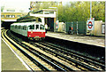

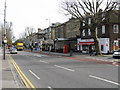
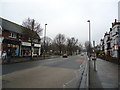

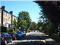
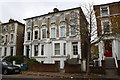


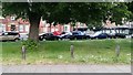


100 photos from this area
Area Information
Key information about the W5 5ND including its size, population, and administrative classification.
- Area Type
- Postcode
- Area Size
- 5030 m²
- Population
- 1476
- Population Density
- 10528 people/km²
House Prices in W5 5ND
25
Properties
£433,350
Average Sold Price
£64,000
Lowest Price
£1,300,000
Highest Price
Showing 25 properties
| Address | Type | Beds | Baths | Last Sale Price | Last Sale Date | |
|---|---|---|---|---|---|---|
| 24 Webster Gardens, Ealing, W5 5ND | Flat | 2 | - | £563,500 | Dec 2022 | |
| 46 Webster Gardens, Ealing, W5 5ND | Flat | 2 | 1 | £450,000 | Oct 2022 | |
| 20 Webster Gardens, Ealing, W5 5ND | Flat | 2 | 1 | £580,000 | Sep 2022 | |
| 44 Webster Gardens, Ealing, W5 5ND | Maisonette | 2 | 1 | £520,000 | Mar 2022 | |
| 14 Webster Gardens, Ealing, W5 5ND | Flat | 1 | 1 | £474,950 | Nov 2020 | |
| 48 Webster Gardens, Ealing, W5 5ND | Maisonette | - | - | £290,000 | Aug 2019 | |
| 2 Webster Gardens, Ealing, W5 5ND | Flat | - | - | £145,500 | May 2016 | |
| 18 Webster Gardens, Ealing, W5 5ND | Flat | - | - | £382,500 | Oct 2013 | |
| 22 Webster Gardens, Ealing, W5 5ND | Flat | 2 | - | £320,000 | Mar 2013 | |
| 52 Webster Gardens, Ealing, W5 5ND | Detached | - | - | £1,300,000 | Nov 2007 |
Page 1 of 3
Energy Efficiency in W5 5ND
Amenities
Schools
| Rank | School | Type | Entry gender | Ages |
|---|
Explore more schools in this area
Go to Schools tabDemographics
Household Size
Two person
most common
Accommodation Type
Flats
most common
Tenure
39
majority
Ethnic Group
White
most common
Religion
N/A
most common
Household Composition
N/A
most common
Age
47
median
Adults (30-64 years)
most common
Household Deprivation
N/A
with no deprivation
NS-SEC
56
in Lower managerial occupations
Explore more demographic insights in this area
Go to Demographics tabPlanning
Planning Constraints
- Flood RiskPremium
- Ramsar Wetland SitesPremium
- Area of Outstanding Natural BeautyPremium
- Protected Nature ReservePremium
- Protected WoodlandPremium