Area Overview for W5 4TA
Photos of W5 4TA


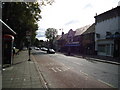
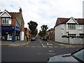


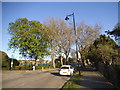

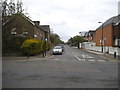
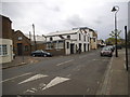
100 photos from this area
Area Information
Key information about the W5 4TA including its size, population, and administrative classification.
- Area Type
- Postcode
- Area Size
- 4983 m²
- Population
- 1798
- Population Density
- 5828 people/km²
House Prices in W5 4TA
55
Properties
£592,800
Average Sold Price
£170,000
Lowest Price
£1,050,000
Highest Price
Showing 55 properties
| Address | Type | Beds | Baths | Last Sale Price | Last Sale Date | |
|---|---|---|---|---|---|---|
| 21 Lothair Road, Ealing, W5 4TA | Terraced | 3 | 1 | £830,000 | Jun 2025 | |
| 14 Lothair Road, Ealing, W5 4TA | Terraced | 4 | 2 | £1,050,000 | Jan 2024 | |
| 26 Lothair Road, Ealing, W5 4TA | Flat | 2 | 1 | £575,000 | Jan 2023 | |
| 27 Lothair Road, Ealing, W5 4TA | house | - | - | £872,500 | Dec 2022 | |
| 22 Lothair Road, Ealing, W5 4TA | house | 1 | 1 | £750,000 | Sep 2022 | |
| 15 Lothair Road, Ealing, W5 4TA | house | - | - | £680,000 | Jan 2021 | |
| 28 Lothair Road, Ealing, W5 4TA | Flat | - | - | £625,000 | Jun 2018 | |
| 13 Lothair Road, Ealing, W5 4TA | Terraced | 3 | 1 | £860,000 | Jun 2017 | |
| 7B Lothair Road, Ealing, W5 4TA | Flat | - | - | £405,000 | May 2016 | |
| 10A Lothair Road, Ealing, W5 4TA | Flat | - | - | £390,000 | Dec 2015 |
Page 1 of 6
Energy Efficiency in W5 4TA
Amenities
Schools
| Rank | School | Type | Entry gender | Ages |
|---|
Explore more schools in this area
Go to Schools tabDemographics
Household Size
Family (3-5 people)
most common
Accommodation Type
Houses
most common
Tenure
63
majority
Ethnic Group
White
most common
Religion
N/A
most common
Household Composition
N/A
most common
Age
47
median
Adults (30-64 years)
most common
Household Deprivation
N/A
with no deprivation
NS-SEC
61
in Lower managerial occupations
Explore more demographic insights in this area
Go to Demographics tabPlanning
Planning Constraints
- Flood RiskPremium
- Ramsar Wetland SitesPremium
- Area of Outstanding Natural BeautyPremium
- Protected Nature ReservePremium
- Protected WoodlandPremium