Area Overview for W5 4NU
Photos of W5 4NU
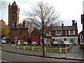

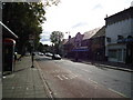
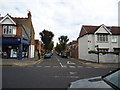

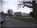

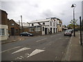
100 photos from this area
Area Information
Key information about the W5 4NU including its size, population, and administrative classification.
- Area Type
- Postcode
- Area Size
- 4413 m²
- Population
- 1444
- Population Density
- 8453 people/km²
House Prices in W5 4NU
29
Properties
£450,813
Average Sold Price
£115,000
Lowest Price
£925,000
Highest Price
Showing 29 properties
| Address | Type | Beds | Baths | Last Sale Price | Last Sale Date | |
|---|---|---|---|---|---|---|
| 31 Popes Lane, Ealing, W5 4NU | Terraced | 3 | 3 | £925,000 | Jun 2023 | |
| 39 Popes Lane, Ealing, W5 4NU | house | 4 | - | £722,000 | Sep 2022 | |
| 33 Popes Lane, Ealing, W5 4NU | house | 4 | 2 | £695,000 | Apr 2022 | |
| 30 Popes Lane, Ealing, W5 4NU | Terraced | 3 | 1 | £630,000 | Dec 2021 | |
| 34 Popes Lane, Ealing, W5 4NU | house | 3 | 1 | £650,000 | Oct 2020 | |
| 43 Popes Lane, Ealing, W5 4NU | Terraced | 3 | 1 | £595,000 | Aug 2019 | |
| 49 Popes Lane, Ealing, W5 4NU | Terraced | 3 | - | £547,500 | Apr 2015 | |
| 35 Popes Lane, Ealing, W5 4NU | house | 3 | - | £403,000 | May 2012 | |
| 41 Popes Lane, Ealing, W5 4NU | Terraced | 3 | 1 | £345,000 | Sep 2011 | |
| 29 Popes Lane, Ealing, W5 4NU | house | 3 | - | £390,000 | May 2011 |
Page 1 of 3
Energy Efficiency in W5 4NU
Amenities
Schools
| Rank | School | Type | Entry gender | Ages |
|---|
Explore more schools in this area
Go to Schools tabDemographics
Household Size
One person
most common
Accommodation Type
Houses
most common
Tenure
45
majority
Ethnic Group
White
most common
Religion
N/A
most common
Household Composition
N/A
most common
Age
47
median
Adults (30-64 years)
most common
Household Deprivation
N/A
with no deprivation
NS-SEC
46
in Lower managerial occupations
Explore more demographic insights in this area
Go to Demographics tabPlanning
Planning Constraints
- Flood RiskPremium
- Ramsar Wetland SitesPremium
- Area of Outstanding Natural BeautyPremium
- Protected Nature ReservePremium
- Protected WoodlandPremium