Area Overview for W5 4ND
Photos of W5 4ND

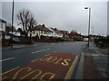
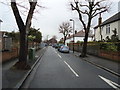


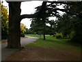
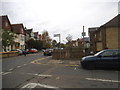
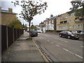
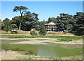

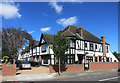
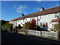
79 photos from this area
Area Information
Key information about the W5 4ND including its size, population, and administrative classification.
- Area Type
- Postcode
- Area Size
- 3.0 hectares
- Population
- 1484
- Population Density
- 1557 people/km²
House Prices in W5 4ND
24
Properties
£613,664
Average Sold Price
£180,000
Lowest Price
£1,025,000
Highest Price
Showing 24 properties
| Address | Type | Beds | Baths | Last Sale Price | Last Sale Date | |
|---|---|---|---|---|---|---|
| 157 Popes Lane, Ealing, W5 4ND | house | - | - | £845,000 | Dec 2025 | |
| 131 Popes Lane, Ealing, W5 4ND | Semi-detached | 3 | 2 | £835,000 | Jan 2022 | |
| 165 Popes Lane, Ealing, W5 4ND | house | - | - | £1,025,000 | Feb 2020 | |
| 145 Popes Lane, Ealing, W5 4ND | Semi-detached | 3 | 1 | £800,000 | Aug 2019 | |
| 177 Popes Lane, Ealing, W5 4ND | Semi-detached | 3 | 1 | £755,000 | Apr 2019 | |
| 169 Popes Lane, Ealing, W5 4ND | Semi-detached | 3 | 1 | £785,000 | Mar 2018 | |
| 175 Popes Lane, Ealing, W5 4ND | Semi-detached | 3 | 1 | £960,000 | Aug 2016 | |
| 153 Popes Lane, Ealing, W5 4ND | Semi-detached | 3 | - | £960,000 | Nov 2014 | |
| 133 Popes Lane, Ealing, W5 4ND | house | 3 | - | £552,000 | Oct 2012 | |
| 143 Popes Lane, Ealing, W5 4ND | house | 4 | - | £575,000 | Jun 2011 |
Page 1 of 3
Energy Efficiency in W5 4ND
Amenities
Schools
| Rank | School | Type | Entry gender | Ages |
|---|
Explore more schools in this area
Go to Schools tabDemographics
Household Size
Family (3-5 people)
most common
Accommodation Type
Houses
most common
Tenure
46
majority
Ethnic Group
White
most common
Religion
N/A
most common
Household Composition
N/A
most common
Age
47
median
Adults (30-64 years)
most common
Household Deprivation
N/A
with no deprivation
NS-SEC
32
in Lower managerial occupations
Explore more demographic insights in this area
Go to Demographics tabPlanning
Planning Constraints
- Flood RiskPremium
- Ramsar Wetland SitesPremium
- Area of Outstanding Natural BeautyPremium
- Protected Nature ReservePremium
- Protected WoodlandPremium