Area Overview for W5 4JS
Photos of W5 4JS
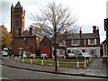
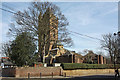
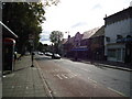
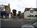
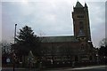
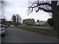
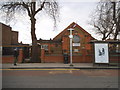
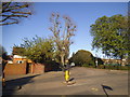
100 photos from this area
Area Information
Key information about the W5 4JS including its size, population, and administrative classification.
- Area Type
- Postcode
- Area Size
- 5855 m²
- Population
- 1518
- Population Density
- 7452 people/km²
House Prices in W5 4JS
28
Properties
£201,565
Average Sold Price
£52,000
Lowest Price
£485,000
Highest Price
Showing 28 properties
| Address | Type | Beds | Baths | Last Sale Price | Last Sale Date | |
|---|---|---|---|---|---|---|
| 55 Chestnut Grove, Ealing, W5 4JS | Maisonette | - | - | £81,200 | Sep 2025 | |
| 54 Chestnut Grove, Ealing, W5 4JS | house | - | - | £485,000 | Aug 2013 | |
| 61 Chestnut Grove, Ealing, W5 4JS | Flat | 3 | - | £230,000 | Oct 2011 | |
| 56 Chestnut Grove, Ealing, W5 4JS | Flat | 3 | 2 | £350,000 | Sep 2010 | |
| 55A Chestnut Grove, Ealing, W5 4JS | Flat | - | - | £215,000 | Jun 2006 | |
| 63 Chestnut Grove, Ealing, W5 4JS | Flat | - | - | £205,000 | Oct 2005 | |
| 51 Chestnut Grove, Ealing, W5 4JS | Flat | - | - | £189,950 | May 2003 | |
| 48 Chestnut Grove, Ealing, W5 4JS | house | - | - | £147,500 | Jul 1999 | |
| 49A Chestnut Grove, Ealing, W5 4JS | Flat | - | - | £60,000 | Feb 1996 | |
| 50 Chestnut Grove, Ealing, W5 4JS | Semi-detached | - | - | £52,000 | Jul 1995 |
Page 1 of 3
Energy Efficiency in W5 4JS
Amenities
Schools
| Rank | School | Type | Entry gender | Ages |
|---|
Explore more schools in this area
Go to Schools tabDemographics
Household Size
Family (3-5 people)
most common
Accommodation Type
Houses
most common
Tenure
43
majority
Ethnic Group
White
most common
Religion
N/A
most common
Household Composition
N/A
most common
Age
47
median
Adults (30-64 years)
most common
Household Deprivation
N/A
with no deprivation
NS-SEC
34
in Lower managerial occupations
Explore more demographic insights in this area
Go to Demographics tabPlanning
Planning Constraints
- Flood RiskPremium
- Ramsar Wetland SitesPremium
- Area of Outstanding Natural BeautyPremium
- Protected Nature ReservePremium
- Protected WoodlandPremium