Area Overview for W5 4DD
Photos of W5 4DD

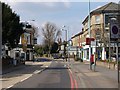
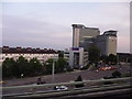


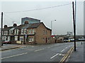


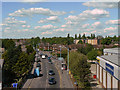
100 photos from this area
Area Information
Key information about the W5 4DD including its size, population, and administrative classification.
- Area Type
- Postcode
- Area Size
- 8246 m²
- Population
- 1658
- Population Density
- 14330 people/km²
House Prices in W5 4DD
37
Properties
£485,100
Average Sold Price
£115,000
Lowest Price
£850,000
Highest Price
Showing 37 properties
| Address | Type | Beds | Baths | Last Sale Price | Last Sale Date | |
|---|---|---|---|---|---|---|
| 165 Murray Road, Ealing, W5 4DD | Semi-detached | 4 | 2 | £665,995 | Apr 2024 | |
| 191 Murray Road, Ealing, W5 4DD | Semi-detached | 3 | 2 | £785,000 | Feb 2023 | |
| 153 Murray Road, Ealing, W5 4DD | Retail | 2 | 1 | £700,000 | Jul 2022 | |
| 167 Murray Road, Ealing, W5 4DD | house | - | - | £675,000 | Jan 2018 | |
| 151 Murray Road, Ealing, W5 4DD | house | 4 | 2 | £850,000 | Jan 2018 | |
| 139 Murray Road, Ealing, W5 4DD | house | - | - | £725,000 | Dec 2015 | |
| 177 Murray Road, Ealing, W5 4DD | Terraced | 2 | 1 | £655,000 | Feb 2015 | |
| 189 Murray Road, Ealing, W5 4DD | house | - | - | £380,000 | Nov 2009 | |
| 183 Murray Road, Ealing, W5 4DD | Terraced | - | - | £550,000 | Mar 2007 | |
| 173 Murray Road, Ealing, W5 4DD | Detached | 4 | 2 | £327,000 | Oct 2006 |
Page 1 of 4
Energy Efficiency in W5 4DD
Amenities
Schools
| Rank | School | Type | Entry gender | Ages |
|---|
Explore more schools in this area
Go to Schools tabDemographics
Household Size
Family (3-5 people)
most common
Accommodation Type
Flats
most common
Tenure
52
majority
Ethnic Group
White
most common
Religion
N/A
most common
Household Composition
N/A
most common
Age
47
median
Adults (30-64 years)
most common
Household Deprivation
N/A
with no deprivation
NS-SEC
54
in Lower managerial occupations
Explore more demographic insights in this area
Go to Demographics tabPlanning
Planning Constraints
- Flood RiskPremium
- Ramsar Wetland SitesPremium
- Area of Outstanding Natural BeautyPremium
- Protected Nature ReservePremium
- Protected WoodlandPremium