Area Overview for W5 3QH
Photos of W5 3QH
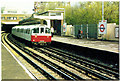
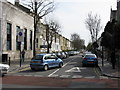
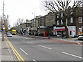
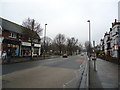

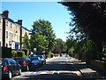
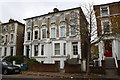
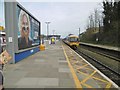
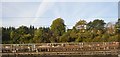
100 photos from this area
Area Information
Key information about the W5 3QH including its size, population, and administrative classification.
- Area Type
- Postcode
- Area Size
- 8844 m²
- Population
- 1370
- Population Density
- 4477 people/km²
House Prices in W5 3QH
13
Properties
£761,750
Average Sold Price
£207,000
Lowest Price
£1,900,000
Highest Price
Showing 13 properties
| Address | Type | Beds | Baths | Last Sale Price | Last Sale Date | |
|---|---|---|---|---|---|---|
| 15 Crosslands Avenue, Ealing, W5 3QH | Terraced | 4 | 2 | £925,000 | Aug 2025 | |
| 5 Crosslands Avenue, Ealing, W5 3QH | Terraced | 4 | 3 | £1,125,000 | Jul 2022 | |
| 3 Crosslands Avenue, Ealing, W5 3QH | Detached | 4 | 2 | £1,900,000 | Apr 2020 | |
| 4 Crosslands Avenue, Ealing, W5 3QH | house | - | - | £609,000 | Nov 2005 | |
| 13 Crosslands Avenue, Ealing, W5 3QH | house | 4 | - | £388,000 | Jun 2003 | |
| 11 Crosslands Avenue, Ealing, W5 3QH | Terraced | 1 | 1 | £440,000 | Aug 2002 | |
| 6 Crosslands Avenue, Ealing, W5 3QH | Detached | 5 | 3 | £500,000 | Sep 1998 | |
| 7 Crosslands Avenue, Ealing, W5 3QH | house | - | - | £207,000 | Oct 1996 | |
| The Mallows, Crosslands Avenue, Ealing, W5 3QH | Detached | 4 | 1 | - | - | |
| 2 Crosslands Avenue, Ealing, W5 3QH | Detached | 5 | 1 | - | - |
Page 1 of 2
Energy Efficiency in W5 3QH
Amenities
Schools
| Rank | School | Type | Entry gender | Ages |
|---|
Explore more schools in this area
Go to Schools tabDemographics
Household Size
Two person
most common
Accommodation Type
Flats
most common
Tenure
43
majority
Ethnic Group
White
most common
Religion
N/A
most common
Household Composition
N/A
most common
Age
47
median
Adults (30-64 years)
most common
Household Deprivation
N/A
with no deprivation
NS-SEC
50
in Lower managerial occupations
Explore more demographic insights in this area
Go to Demographics tabPlanning
Planning Constraints
- Flood RiskPremium
- Ramsar Wetland SitesPremium
- Area of Outstanding Natural BeautyPremium
- Protected Nature ReservePremium
- Protected WoodlandPremium