Area Overview for W5 2SW
Photos of W5 2SW
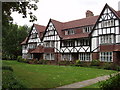
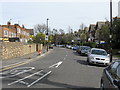
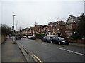
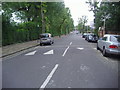
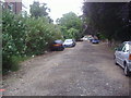
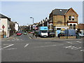
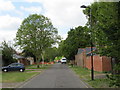

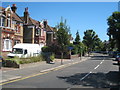

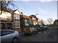
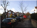
100 photos from this area
Area Information
Key information about the W5 2SW including its size, population, and administrative classification.
- Area Type
- Postcode
- Area Size
- 2539 m²
- Population
- 1454
- Population Density
- 6509 people/km²
House Prices in W5 2SW
15
Properties
£393,944
Average Sold Price
£90,500
Lowest Price
£537,000
Highest Price
Showing 15 properties
| Address | Type | Beds | Baths | Last Sale Price | Last Sale Date | |
|---|---|---|---|---|---|---|
| 4 Hall Close, Ealing, W5 2SW | Flat | 2 | 1 | £537,000 | Mar 2023 | |
| 3 Hall Close, Ealing, W5 2SW | Flat | - | - | £520,000 | Sep 2021 | |
| 14 Hall Close, Ealing, W5 2SW | Flat | - | - | £495,000 | Aug 2016 | |
| 9 Hall Close, Ealing, W5 2SW | Flat | - | - | £480,000 | Sep 2014 | |
| 8 Hall Close, Ealing, W5 2SW | Flat | 2 | 1 | £530,050 | Aug 2014 | |
| 6 Hall Close, Ealing, W5 2SW | Flat | - | - | £380,000 | Oct 2013 | |
| 13 Hall Close, Ealing, W5 2SW | Flat | 2 | - | £339,950 | Jun 2012 | |
| 15 Hall Close, Ealing, W5 2SW | Flat | - | - | £173,000 | May 2000 | |
| 1 Hall Close, Ealing, W5 2SW | Flat | 2 | 1 | £90,500 | Jan 1997 | |
| 2 Hall Close, Ealing, W5 2SW | Flat | - | - | - | - |
Page 1 of 2
Energy Efficiency in W5 2SW
Amenities
Schools
| Rank | School | Type | Entry gender | Ages |
|---|
Explore more schools in this area
Go to Schools tabDemographics
Household Size
One person
most common
Accommodation Type
Flats
most common
Tenure
47
majority
Ethnic Group
White
most common
Religion
N/A
most common
Household Composition
N/A
most common
Age
47
median
Adults (30-64 years)
most common
Household Deprivation
N/A
with no deprivation
NS-SEC
56
in Lower managerial occupations
Explore more demographic insights in this area
Go to Demographics tabPlanning
Planning Constraints
- Flood RiskPremium
- Ramsar Wetland SitesPremium
- Area of Outstanding Natural BeautyPremium
- Protected Nature ReservePremium
- Protected WoodlandPremium