Area Overview for W4 2SE
Photos of W4 2SE

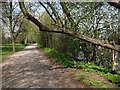
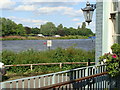
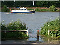
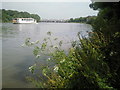
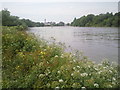
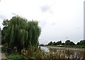
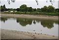
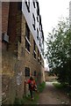
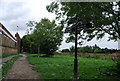
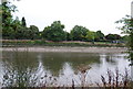
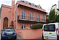
100 photos from this area
Area Information
Key information about the W4 2SE including its size, population, and administrative classification.
- Area Type
- Postcode
- Area Size
- 3511 m²
- Population
- 1545
- Population Density
- 1702 people/km²
House Prices in W4 2SE
14
Properties
£488,750
Average Sold Price
£168,000
Lowest Price
£630,000
Highest Price
Showing 14 properties
| Address | Type | Beds | Baths | Last Sale Price | Last Sale Date | |
|---|---|---|---|---|---|---|
| 101 Staveley Gardens, Chiswick, London, W4 2SE | Terraced | 3 | 1 | £630,000 | Feb 2025 | |
| 95 Staveley Gardens, Chiswick, London, W4 2SE | house | 3 | 1 | £630,000 | May 2021 | |
| 108 Staveley Gardens, Chiswick, London, W4 2SE | house | 3 | - | £590,000 | Aug 2015 | |
| 103 Staveley Gardens, Chiswick, London, W4 2SE | Terraced | 3 | 2 | £569,500 | Mar 2015 | |
| 102 Staveley Gardens, Chiswick, London, W4 2SE | Terraced | 3 | - | £345,000 | Dec 2010 | |
| 107 Staveley Gardens, Chiswick, London, W4 2SE | Terraced | - | - | £168,000 | May 2001 | |
| 106 Staveley Gardens, Chiswick, London, W4 2SE | house | 2 | - | - | - | |
| 97 Staveley Gardens, Chiswick, London, W4 2SE | Terraced | - | - | - | - | |
| 98 Staveley Gardens, Chiswick, London, W4 2SE | Terraced | - | - | - | - | |
| 105 Staveley Gardens, Chiswick, London, W4 2SE | Terraced | - | - | - | - |
Page 1 of 2
Energy Efficiency in W4 2SE
Amenities
Schools
| Rank | School | Type | Entry gender | Ages |
|---|
Explore more schools in this area
Go to Schools tabDemographics
Household Size
Family (3-5 people)
most common
Accommodation Type
Flats
most common
Tenure
33
majority
Ethnic Group
White
most common
Religion
N/A
most common
Household Composition
N/A
most common
Age
47
median
Adults (30-64 years)
most common
Household Deprivation
N/A
with no deprivation
NS-SEC
35
in Lower managerial occupations
Explore more demographic insights in this area
Go to Demographics tabPlanning
Planning Constraints
- Flood RiskPremium
- Ramsar Wetland SitesPremium
- Area of Outstanding Natural BeautyPremium
- Protected Nature ReservePremium
- Protected WoodlandPremium