Area Overview for W4 1DA
Photos of W4 1DA
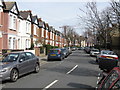
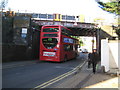
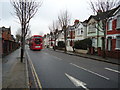
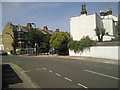
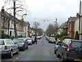
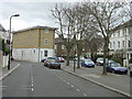
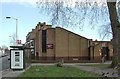
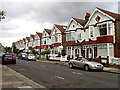
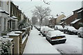
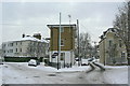
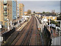
100 photos from this area
Area Information
Key information about the W4 1DA including its size, population, and administrative classification.
- Area Type
- Postcode
- Area Size
- 8886 m²
- Population
- 1736
- Population Density
- 13033 people/km²
House Prices in W4 1DA
49
Properties
£898,955
Average Sold Price
£146,500
Lowest Price
£1,596,990
Highest Price
Showing 49 properties
| Address | Type | Beds | Baths | Last Sale Price | Last Sale Date | |
|---|---|---|---|---|---|---|
| 83 Fielding Road, Chiswick, W4 1DA | Terraced | 3 | 2 | £1,440,000 | Jul 2025 | |
| 67 Fielding Road, Chiswick, W4 1DA | Terraced | 4 | 2 | £1,596,990 | Nov 2023 | |
| 111 Fielding Road, Chiswick, W4 1DA | Terraced | 3 | 2 | £1,250,050 | Jul 2023 | |
| 71 Fielding Road, Chiswick, W4 1DA | Terraced | 3 | 2 | £1,385,000 | Dec 2022 | |
| 77 Fielding Road, Chiswick, W4 1DA | Flat | - | - | £690,000 | Jul 2022 | |
| 65 Fielding Road, Chiswick, W4 1DA | Terraced | 4 | 2 | £1,515,000 | Jun 2022 | |
| 133 Fielding Road, Chiswick, W4 1DA | Terraced | 3 | - | £1,325,000 | Sep 2021 | |
| 107 Fielding Road, Chiswick, W4 1DA | house | - | - | £1,110,000 | Dec 2020 | |
| 93 Fielding Road, Chiswick, W4 1DA | house | - | - | £1,100,000 | Aug 2020 | |
| 61 Fielding Road, Chiswick, W4 1DA | Terraced | 4 | 2 | £1,157,000 | Aug 2019 |
Page 1 of 5
Energy Efficiency in W4 1DA
Amenities
Schools
| Rank | School | Type | Entry gender | Ages |
|---|
Explore more schools in this area
Go to Schools tabDemographics
Household Size
Family (3-5 people)
most common
Accommodation Type
Houses
most common
Tenure
69
majority
Ethnic Group
White
most common
Religion
N/A
most common
Household Composition
N/A
most common
Age
47
median
Adults (30-64 years)
most common
Household Deprivation
N/A
with no deprivation
NS-SEC
64
in Lower managerial occupations
Explore more demographic insights in this area
Go to Demographics tabPlanning
Planning Constraints
- Flood RiskPremium
- Ramsar Wetland SitesPremium
- Area of Outstanding Natural BeautyPremium
- Protected Nature ReservePremium
- Protected WoodlandPremium