Area Overview for W3 9QA
Photos of W3 9QA
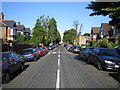
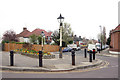
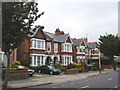
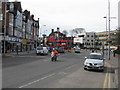
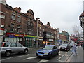
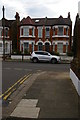
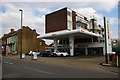

100 photos from this area
Area Information
Key information about the W3 9QA including its size, population, and administrative classification.
- Area Type
- Postcode
- Area Size
- 2.5 hectares
- Population
- 2056
- Population Density
- 7601 people/km²
House Prices in W3 9QA
43
Properties
£1,061,500
Average Sold Price
£272,000
Lowest Price
£2,065,000
Highest Price
Showing 43 properties
| Address | Type | Beds | Baths | Last Sale Price | Last Sale Date | |
|---|---|---|---|---|---|---|
| 16 Twyford Avenue, Acton, W3 9QA | Semi-detached | 6 | 3 | £1,340,000 | Mar 2023 | |
| 8 TWYFORD AVENUE, Acton, W3 9QA | Flat | - | - | £1,685,000 | Apr 2021 | |
| 6 Twyford Avenue, Acton, W3 9QA | Detached | 5 | 3 | £2,065,000 | Apr 2017 | |
| 24 Twyford Avenue, Acton, W3 9QA | house | - | - | £1,400,000 | Nov 2012 | |
| 2 Twyford Avenue, Acton, W3 9QA | Semi-detached | 1 | 1 | £665,000 | May 2009 | |
| 10A Twyford Avenue, Acton, W3 9QA | Flat | 2 | 2 | £415,000 | Jan 2008 | |
| 22 Twyford Avenue, Acton, W3 9QA | Terraced | 5 | - | £650,000 | Mar 2007 | |
| 26 Twyford Avenue, Acton, W3 9QA | Terraced | - | - | £272,000 | Mar 1998 | |
| Flat 5, Twyford House, 8 Twyford Avenue, Acton, W3 9QA | Flat | 2 | 2 | - | - | |
| Flat 4, Twyford House, 8 Twyford Avenue, Acton, W3 9QA | Flat | 2 | 2 | - | - |
Page 1 of 5
Energy Efficiency in W3 9QA
Amenities
Schools
| Rank | School | Type | Entry gender | Ages |
|---|
Explore more schools in this area
Go to Schools tabDemographics
Household Size
One person
most common
Accommodation Type
Flats
most common
Tenure
45
majority
Ethnic Group
White
most common
Religion
N/A
most common
Household Composition
N/A
most common
Age
47
median
Adults (30-64 years)
most common
Household Deprivation
N/A
with no deprivation
NS-SEC
48
in Lower managerial occupations
Explore more demographic insights in this area
Go to Demographics tabPlanning
Planning Constraints
- Flood RiskPremium
- Ramsar Wetland SitesPremium
- Area of Outstanding Natural BeautyPremium
- Protected Nature ReservePremium
- Protected WoodlandPremium