Area Overview for W3 9LN
Photos of W3 9LN
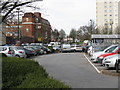

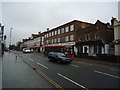
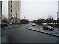
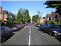
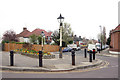
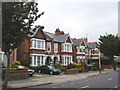
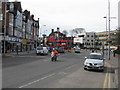
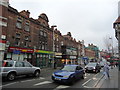

100 photos from this area
Area Information
Key information about the W3 9LN including its size, population, and administrative classification.
- Area Type
- Postcode
- Area Size
- 6891 m²
- Population
- 1972
- Population Density
- 10165 people/km²
House Prices in W3 9LN
42
Properties
£765,839
Average Sold Price
£205,000
Lowest Price
£1,250,888
Highest Price
Showing 42 properties
| Address | Type | Beds | Baths | Last Sale Price | Last Sale Date | |
|---|---|---|---|---|---|---|
| 20 Chatsworth Gardens, Acton, W3 9LN | Terraced | 6 | 2 | £1,100,000 | Mar 2025 | |
| 21 Chatsworth Gardens, Acton, W3 9LN | Semi-detached | 4 | 2 | £1,075,000 | Jun 2024 | |
| 22 Chatsworth Gardens, Acton, W3 9LN | Detached | 6 | 5 | £1,250,888 | Apr 2024 | |
| 8 Chatsworth Gardens, Acton, W3 9LN | Semi-detached | 7 | 2 | £852,000 | Jul 2023 | |
| 17 Chatsworth Gardens, Acton, W3 9LN | house | - | - | £1,100,000 | Nov 2022 | |
| 13A Chatsworth Gardens, Acton, W3 9LN | Flat | 2 | 2 | £542,500 | Jun 2022 | |
| 24 Chatsworth Gardens, Acton, W3 9LN | Semi-detached | 6 | 3 | £770,000 | Nov 2012 | |
| 2 Chatsworth Gardens, Acton, W3 9LN | Semi-detached | 4 | 1 | £530,000 | Sep 2005 | |
| 10 Chatsworth Gardens, Acton, W3 9LN | Semi-detached | 6 | 3 | £205,000 | Apr 1998 | |
| 14 Chatsworth Gardens, Acton, W3 9LN | Semi-detached | - | - | £233,000 | Mar 1998 |
Page 1 of 5
Energy Efficiency in W3 9LN
Amenities
Schools
| Rank | School | Type | Entry gender | Ages |
|---|
Explore more schools in this area
Go to Schools tabDemographics
Household Size
One person
most common
Accommodation Type
Flats
most common
Tenure
37
majority
Ethnic Group
White
most common
Religion
N/A
most common
Household Composition
N/A
most common
Age
47
median
Adults (30-64 years)
most common
Household Deprivation
N/A
with no deprivation
NS-SEC
37
in Lower managerial occupations
Explore more demographic insights in this area
Go to Demographics tabPlanning
Planning Constraints
- Flood RiskPremium
- Ramsar Wetland SitesPremium
- Area of Outstanding Natural BeautyPremium
- Protected Nature ReservePremium
- Protected WoodlandPremium