Area Overview for W3 8AW
Photos of W3 8AW
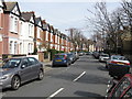


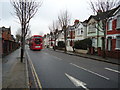
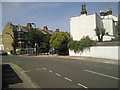
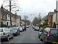
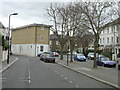
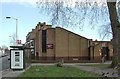
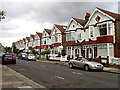
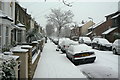
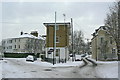
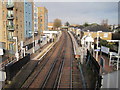
100 photos from this area
Area Information
Key information about the W3 8AW including its size, population, and administrative classification.
- Area Type
- Postcode
- Area Size
- 9779 m²
- Population
- 1957
- Population Density
- 13377 people/km²
House Prices in W3 8AW
78
Properties
£638,667
Average Sold Price
£194,250
Lowest Price
£1,180,000
Highest Price
Showing 78 properties
| Address | Type | Beds | Baths | Last Sale Price | Last Sale Date | |
|---|---|---|---|---|---|---|
| 13 Leythe Road, Acton, W3 8AW | Terraced | 3 | 1 | £895,000 | Jul 2023 | |
| 31 Leythe Road, Acton, W3 8AW | Terraced | 5 | 3 | £865,000 | Dec 2021 | |
| 34 Leythe Road, Acton, W3 8AW | Terraced | 3 | 2 | £825,000 | Apr 2021 | |
| 36 Leythe Road, Acton, W3 8AW | Terraced | 4 | - | £1,180,000 | Sep 2019 | |
| 41 Leythe Road, Acton, W3 8AW | house | - | - | £545,000 | May 2012 | |
| 21 Leythe Road, Acton, W3 8AW | house | 2 | - | £457,500 | Mar 2012 | |
| 42 Leythe Road, Acton, W3 8AW | Terraced | - | - | £572,500 | Jan 2008 | |
| 38A Leythe Road, Acton, W3 8AW | Flat | - | - | £194,250 | Jan 2001 | |
| 38 Leythe Road, Acton, W3 8AW | house | 2 | 1 | £213,750 | Aug 2000 | |
| 2 Leythe Road, Acton, W3 8AW | Terraced | 4 | 3 | - | - |
Page 1 of 8
Energy Efficiency in W3 8AW
Amenities
Schools
| Rank | School | Type | Entry gender | Ages |
|---|
Explore more schools in this area
Go to Schools tabDemographics
Household Size
One person
most common
Accommodation Type
Flats
most common
Tenure
43
majority
Ethnic Group
White
most common
Religion
N/A
most common
Household Composition
N/A
most common
Age
47
median
Adults (30-64 years)
most common
Household Deprivation
N/A
with no deprivation
NS-SEC
45
in Lower managerial occupations
Explore more demographic insights in this area
Go to Demographics tabPlanning
Planning Constraints
- Flood RiskPremium
- Ramsar Wetland SitesPremium
- Area of Outstanding Natural BeautyPremium
- Protected Nature ReservePremium
- Protected WoodlandPremium