Area Overview for W3 8AB
Photos of W3 8AB
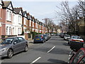
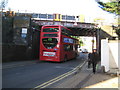
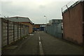
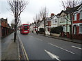
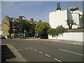
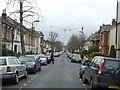
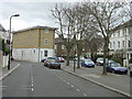
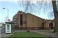
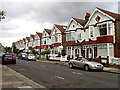
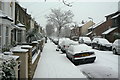
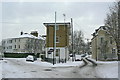
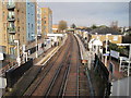
100 photos from this area
Area Information
Key information about the W3 8AB including its size, population, and administrative classification.
- Area Type
- Postcode
- Area Size
- 9502 m²
- Population
- 1972
- Population Density
- 10165 people/km²
House Prices in W3 8AB
93
Properties
£526,412
Average Sold Price
£117,000
Lowest Price
£1,090,000
Highest Price
Showing 93 properties
| Address | Type | Beds | Baths | Last Sale Price | Last Sale Date | |
|---|---|---|---|---|---|---|
| 50 Berrymead Gardens, Acton, W3 8AB | Terraced | 4 | 3 | £885,000 | Sep 2024 | |
| 70 BERRYMEAD GARDENS, Acton, W3 8AB | Flat | 1 | 1 | £1,090,000 | Nov 2023 | |
| 56 Berrymead Gardens, Acton, W3 8AB | Flat | 2 | 1 | £510,000 | May 2022 | |
| 34 Berrymead Gardens, Acton, W3 8AB | Flat | 2 | 1 | £815,000 | Feb 2017 | |
| 42 Berrymead Gardens, Acton, W3 8AB | Terraced | - | - | £487,500 | Aug 2016 | |
| 35 Berrymead Gardens, Acton, W3 8AB | Terraced | 2 | 1 | £815,000 | Mar 2016 | |
| 61 Berrymead Gardens, Acton, W3 8AB | Terraced | 3 | - | £735,000 | May 2014 | |
| 87 Berrymead Gardens, Acton, W3 8AB | Terraced | 4 | 2 | £620,000 | Jan 2013 | |
| 81 Berrymead Gardens, Acton, W3 8AB | Terraced | 4 | - | £540,000 | Oct 2012 | |
| 65 Berrymead Gardens, Acton, W3 8AB | Terraced | 4 | 3 | £495,000 | Mar 2012 |
Page 1 of 10
Energy Efficiency in W3 8AB
Amenities
Schools
| Rank | School | Type | Entry gender | Ages |
|---|
Explore more schools in this area
Go to Schools tabDemographics
Household Size
One person
most common
Accommodation Type
Flats
most common
Tenure
37
majority
Ethnic Group
White
most common
Religion
N/A
most common
Household Composition
N/A
most common
Age
47
median
Adults (30-64 years)
most common
Household Deprivation
N/A
with no deprivation
NS-SEC
37
in Lower managerial occupations
Explore more demographic insights in this area
Go to Demographics tabPlanning
Planning Constraints
- Flood RiskPremium
- Ramsar Wetland SitesPremium
- Area of Outstanding Natural BeautyPremium
- Protected Nature ReservePremium
- Protected WoodlandPremium