Area Overview for W3 7NG
Photos of W3 7NG
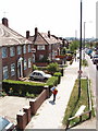
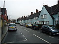
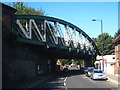
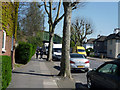
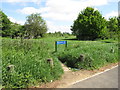
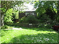
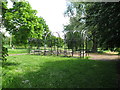
100 photos from this area
Area Information
Key information about the W3 7NG including its size, population, and administrative classification.
- Area Type
- Postcode
- Area Size
- 5346 m²
- Population
- 1855
- Population Density
- 5254 people/km²
House Prices in W3 7NG
22
Properties
£470,833
Average Sold Price
£100,000
Lowest Price
£675,000
Highest Price
Showing 22 properties
| Address | Type | Beds | Baths | Last Sale Price | Last Sale Date | |
|---|---|---|---|---|---|---|
| 6 CARLISLE AVENUE, Acton, W3 7NG | Semi-detached | 4 | 1 | £675,000 | Jun 2021 | |
| 4 Carlisle Avenue, Acton, W3 7NG | Flat | 2 | 1 | £575,000 | Jan 2020 | |
| 15 Carlisle Avenue, Acton, W3 7NG | house | 3 | 1 | £510,000 | Sep 2015 | |
| 9 Carlisle Avenue, Acton, W3 7NG | house | - | - | £590,000 | Dec 2014 | |
| 12 Carlisle Avenue, Acton, W3 7NG | Terraced | 5 | 1 | £375,000 | Aug 2006 | |
| 13 Carlisle Avenue, Acton, W3 7NG | Terraced | - | - | £100,000 | Feb 1997 | |
| 11 Carlisle Avenue, Acton, W3 7NG | Terraced | 4 | 3 | - | - | |
| 10 Carlisle Avenue, Acton, W3 7NG | Terraced | 3 | 1 | - | - | |
| Annexe, 9 Carlisle Avenue, Acton, W3 7NG | Flat | - | - | - | - | |
| Flat 1, 2 Carlisle Avenue, Acton, W3 7NG | Flat | - | - | - | - |
Page 1 of 3
Energy Efficiency in W3 7NG
Amenities
Schools
| Rank | School | Type | Entry gender | Ages |
|---|
Explore more schools in this area
Go to Schools tabDemographics
Household Size
Family (3-5 people)
most common
Accommodation Type
Flats
most common
Tenure
42
majority
Ethnic Group
White
most common
Religion
N/A
most common
Household Composition
N/A
most common
Age
47
median
Adults (30-64 years)
most common
Household Deprivation
N/A
with no deprivation
NS-SEC
33
in Lower managerial occupations
Explore more demographic insights in this area
Go to Demographics tabPlanning
Planning Constraints
- Flood RiskPremium
- Ramsar Wetland SitesPremium
- Area of Outstanding Natural BeautyPremium
- Protected Nature ReservePremium
- Protected WoodlandPremium