Area Overview for W3 0JS
Photos of W3 0JS
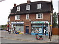
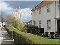
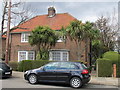

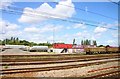
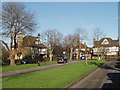
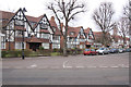
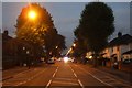
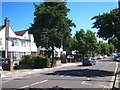
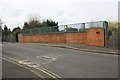
100 photos from this area
Area Information
Key information about the W3 0JS including its size, population, and administrative classification.
- Area Type
- Postcode
- Area Size
- 1.0 hectares
- Population
- 1824
- Population Density
- 4403 people/km²
House Prices in W3 0JS
37
Properties
£411,967
Average Sold Price
£130,000
Lowest Price
£1,050,000
Highest Price
Showing 37 properties
| Address | Type | Beds | Baths | Last Sale Price | Last Sale Date | |
|---|---|---|---|---|---|---|
| 104 Noel Road, Acton, W3 0JS | Semi-detached | 5 | 4 | £1,050,000 | Sep 2022 | |
| 112 Noel Road, Acton, W3 0JS | house | 1 | 1 | £630,000 | Jun 2017 | |
| 98 Noel Road, Acton, W3 0JS | Terraced | 3 | 1 | £635,000 | Sep 2015 | |
| 110 Noel Road, Acton, W3 0JS | Semi-detached | 4 | 1 | £790,000 | Sep 2015 | |
| 84 Noel Road, Acton, W3 0JS | house | - | - | £382,000 | May 2012 | |
| 86 Noel Road, Acton, W3 0JS | Semi-detached | 3 | - | £455,000 | May 2012 | |
| 78 Noel Road, Acton, W3 0JS | house | 4 | 1 | £327,500 | Jan 2012 | |
| 90 Noel Road, Acton, W3 0JS | Semi-detached | 3 | - | £490,000 | Nov 2010 | |
| 102 Noel Road, Acton, W3 0JS | Semi-detached | 3 | 1 | £345,000 | Sep 2006 | |
| 82 Noel Road, Acton, W3 0JS | Terraced | - | - | £223,000 | May 2002 |
Page 1 of 4
Energy Efficiency in W3 0JS
Amenities
Schools
| Rank | School | Type | Entry gender | Ages |
|---|
Explore more schools in this area
Go to Schools tabDemographics
Household Size
Family (3-5 people)
most common
Accommodation Type
Houses
most common
Tenure
55
majority
Ethnic Group
White
most common
Religion
N/A
most common
Household Composition
N/A
most common
Age
47
median
Adults (30-64 years)
most common
Household Deprivation
N/A
with no deprivation
NS-SEC
38
in Lower managerial occupations
Explore more demographic insights in this area
Go to Demographics tabPlanning
Planning Constraints
- Flood RiskPremium
- Ramsar Wetland SitesPremium
- Area of Outstanding Natural BeautyPremium
- Protected Nature ReservePremium
- Protected WoodlandPremium