Area Overview for W13 9RA
Photos of W13 9RA
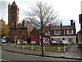
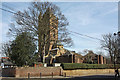
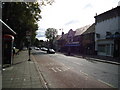
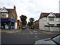
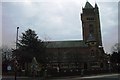
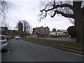
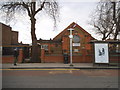
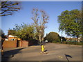
100 photos from this area
Area Information
Key information about the W13 9RA including its size, population, and administrative classification.
- Area Type
- Postcode
- Area Size
- 1.5 hectares
- Population
- 1481
- Population Density
- 7260 people/km²
House Prices in W13 9RA
66
Properties
£738,780
Average Sold Price
£138,500
Lowest Price
£1,280,000
Highest Price
Showing 66 properties
| Address | Type | Beds | Baths | Last Sale Price | Last Sale Date | |
|---|---|---|---|---|---|---|
| 75 Leyborne Avenue, West Ealing, W13 9RA | house | 3 | 1 | £1,035,000 | May 2025 | |
| 68 Leyborne Avenue, West Ealing, W13 9RA | Terraced | 4 | 2 | £1,280,000 | Jul 2024 | |
| 40 Leyborne Avenue, West Ealing, W13 9RA | Terraced | 4 | 2 | £1,097,500 | Oct 2023 | |
| 55 Leyborne Avenue, West Ealing, W13 9RA | Terraced | 3 | 1 | £880,000 | Mar 2023 | |
| 61 Leyborne Avenue, West Ealing, W13 9RA | house | 5 | - | £1,180,000 | Nov 2021 | |
| 25 Leyborne Avenue, West Ealing, W13 9RA | house | - | - | £827,600 | Nov 2020 | |
| 30 Leyborne Avenue, West Ealing, W13 9RA | Terraced | 3 | - | £953,000 | Nov 2019 | |
| 34 Leyborne Avenue, West Ealing, W13 9RA | Terraced | 3 | 1 | £1,160,000 | Oct 2019 | |
| 27 Leyborne Avenue, West Ealing, W13 9RA | Terraced | 4 | 2 | £835,000 | Oct 2019 | |
| 71 Leyborne Avenue, West Ealing, W13 9RA | Terraced | 3 | - | £850,000 | Jul 2018 |
Page 1 of 7
Energy Efficiency in W13 9RA
Amenities
Schools
| Rank | School | Type | Entry gender | Ages |
|---|
Explore more schools in this area
Go to Schools tabDemographics
Household Size
Family (3-5 people)
most common
Accommodation Type
Houses
most common
Tenure
80
majority
Ethnic Group
White
most common
Religion
N/A
most common
Household Composition
N/A
most common
Age
47
median
Adults (30-64 years)
most common
Household Deprivation
N/A
with no deprivation
NS-SEC
58
in Lower managerial occupations
Explore more demographic insights in this area
Go to Demographics tabPlanning
Planning Constraints
- Flood RiskPremium
- Ramsar Wetland SitesPremium
- Area of Outstanding Natural BeautyPremium
- Protected Nature ReservePremium
- Protected WoodlandPremium