Area Overview for W13 9PS
Photos of W13 9PS
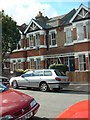
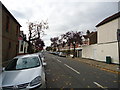
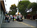
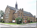

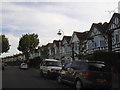
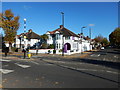
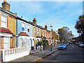
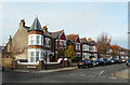
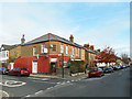
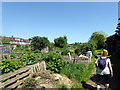
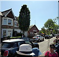
65 photos from this area
Area Information
Key information about the W13 9PS including its size, population, and administrative classification.
- Area Type
- Postcode
- Area Size
- 6988 m²
- Population
- 1481
- Population Density
- 7260 people/km²
House Prices in W13 9PS
35
Properties
£772,137
Average Sold Price
£149,950
Lowest Price
£1,325,000
Highest Price
Showing 35 properties
| Address | Type | Beds | Baths | Last Sale Price | Last Sale Date | |
|---|---|---|---|---|---|---|
| 43 Kingsdown Avenue, West Ealing, W13 9PS | house | 4 | 2 | £1,320,000 | May 2025 | |
| 19 Kingsdown Avenue, West Ealing, W13 9PS | Semi-detached | 4 | 2 | £1,110,000 | Feb 2023 | |
| 47A Kingsdown Avenue, West Ealing, W13 9PS | Retail | 5 | 2 | £1,325,000 | Mar 2022 | |
| 39 Kingsdown Avenue, West Ealing, W13 9PS | house | - | - | £1,100,000 | Jan 2022 | |
| 65 Kingsdown Avenue, West Ealing, W13 9PS | house | - | - | £1,276,000 | Oct 2021 | |
| 71 Kingsdown Avenue, West Ealing, W13 9PS | Semi-detached | 4 | - | £1,296,000 | Jun 2021 | |
| 41 Kingsdown Avenue, West Ealing, W13 9PS | Semi-detached | 4 | - | £950,000 | Feb 2020 | |
| 45 Kingsdown Avenue, West Ealing, W13 9PS | Terraced | 3 | - | £1,090,000 | Jan 2019 | |
| 35 Kingsdown Avenue, West Ealing, W13 9PS | Semi-detached | 4 | - | £1,050,000 | Jun 2017 | |
| 51 Kingsdown Avenue, West Ealing, W13 9PS | Semi-detached | 6 | 2 | £1,173,338 | Jun 2017 |
Page 1 of 4
Energy Efficiency in W13 9PS
Amenities
Schools
| Rank | School | Type | Entry gender | Ages |
|---|
Explore more schools in this area
Go to Schools tabDemographics
Household Size
Family (3-5 people)
most common
Accommodation Type
Houses
most common
Tenure
80
majority
Ethnic Group
White
most common
Religion
N/A
most common
Household Composition
N/A
most common
Age
47
median
Adults (30-64 years)
most common
Household Deprivation
N/A
with no deprivation
NS-SEC
58
in Lower managerial occupations
Explore more demographic insights in this area
Go to Demographics tabPlanning
Planning Constraints
- Flood RiskPremium
- Ramsar Wetland SitesPremium
- Area of Outstanding Natural BeautyPremium
- Protected Nature ReservePremium
- Protected WoodlandPremium