Area Overview for W13 9NJ
Photos of W13 9NJ
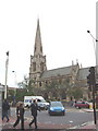
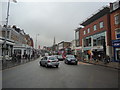

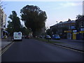
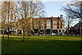


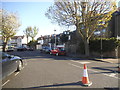
100 photos from this area
Area Information
Key information about the W13 9NJ including its size, population, and administrative classification.
- Area Type
- Postcode
- Area Size
- 5.6 hectares
- Population
- 1798
- Population Density
- 5828 people/km²
House Prices in W13 9NJ
33
Properties
£1,580,765
Average Sold Price
£415,000
Lowest Price
£3,800,000
Highest Price
Showing 33 properties
| Address | Type | Beds | Baths | Last Sale Price | Last Sale Date | |
|---|---|---|---|---|---|---|
| 25 Culmington Road, West Ealing, W13 9NJ | Detached | 6 | 3 | £2,710,000 | Jul 2023 | |
| 17 Culmington Road, West Ealing, W13 9NJ | Detached | 5 | 2 | £3,800,000 | Nov 2022 | |
| 41 Culmington Road, West Ealing, W13 9NJ | house | - | - | £2,080,000 | Nov 2020 | |
| 51 Culmington Road, West Ealing, W13 9NJ | house | - | - | £1,900,000 | Feb 2017 | |
| 29 Culmington Road, West Ealing, W13 9NJ | house | 4 | 2 | £1,675,000 | Feb 2014 | |
| 49 Culmington Road, West Ealing, W13 9NJ | house | - | - | £1,560,000 | Nov 2012 | |
| 19 Culmington Road, West Ealing, W13 9NJ | Detached | - | - | £1,850,000 | Aug 2007 | |
| 39 Culmington Road, West Ealing, W13 9NJ | house | - | - | £1,125,000 | May 2007 | |
| 43 Culmington Road, West Ealing, W13 9NJ | Detached | - | - | £955,000 | Feb 2006 | |
| 13 Culmington Road, West Ealing, W13 9NJ | Detached | 3 | 1 | £1,200,000 | Sep 2002 |
Page 1 of 4
Energy Efficiency in W13 9NJ
Amenities
Schools
| Rank | School | Type | Entry gender | Ages |
|---|
Explore more schools in this area
Go to Schools tabDemographics
Household Size
Family (3-5 people)
most common
Accommodation Type
Houses
most common
Tenure
63
majority
Ethnic Group
White
most common
Religion
N/A
most common
Household Composition
N/A
most common
Age
47
median
Adults (30-64 years)
most common
Household Deprivation
N/A
with no deprivation
NS-SEC
61
in Lower managerial occupations
Explore more demographic insights in this area
Go to Demographics tabPlanning
Planning Constraints
- Flood RiskPremium
- Ramsar Wetland SitesPremium
- Area of Outstanding Natural BeautyPremium
- Protected Nature ReservePremium
- Protected WoodlandPremium