Area Overview for W13 8BP
Photos of W13 8BP
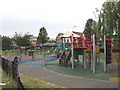
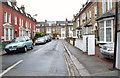


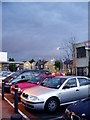
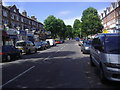


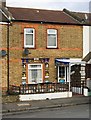
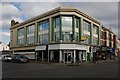


100 photos from this area
Area Information
Key information about the W13 8BP including its size, population, and administrative classification.
- Area Type
- Postcode
- Area Size
- Not available
- Population
- 1230
- Population Density
- 12487 people/km²
House Prices in W13 8BP
76
Properties
£605,108
Average Sold Price
£435,000
Lowest Price
£848,000
Highest Price
Showing 76 properties
| Address | Type | Beds | Baths | Last Sale Price | Last Sale Date | |
|---|---|---|---|---|---|---|
| 2, Broxburn House, Bathgate Place, West Ealing, W13 8BP | Maisonette | 3 | 2 | £790,000 | Feb 2024 | |
| 18, Broxburn House, Bathgate Place, West Ealing, W13 8BP | Flat | - | - | £778,000 | Jun 2023 | |
| 13, Broxburn House, Bathgate Place, West Ealing, W13 8BP | Flat | - | - | £790,000 | Mar 2023 | |
| 42, Broxburn House, Bathgate Place, West Ealing, W13 8BP | Flat | 1 | 1 | £459,557 | Feb 2023 | |
| 14, Broxburn House, Bathgate Place, West Ealing, W13 8BP | Flat | 1 | 1 | £497,853 | Feb 2023 | |
| 45, Broxburn House, Bathgate Place, West Ealing, W13 8BP | Flat | 2 | 2 | £637,500 | Dec 2022 | |
| 54, Broxburn House, Bathgate Place, West Ealing, W13 8BP | Flat | - | - | £491,000 | Dec 2022 | |
| 65, Broxburn House, Bathgate Place, West Ealing, W13 8BP | Flat | - | - | £512,500 | Dec 2022 | |
| 59, Broxburn House, Bathgate Place, West Ealing, W13 8BP | Flat | - | - | £600,000 | Nov 2022 | |
| 24, Broxburn House, Bathgate Place, West Ealing, W13 8BP | Flat | - | - | £475,000 | Oct 2022 |
Page 1 of 8
Energy Efficiency in W13 8BP
Amenities
Schools
| Rank | School | Type | Entry gender | Ages |
|---|
Explore more schools in this area
Go to Schools tabDemographics
Household Size
One person
most common
Accommodation Type
Flats
most common
Tenure
24
majority
Ethnic Group
White
most common
Religion
N/A
most common
Household Composition
N/A
most common
Age
47
median
Adults (30-64 years)
most common
Household Deprivation
N/A
with no deprivation
NS-SEC
40
in Lower managerial occupations
Explore more demographic insights in this area
Go to Demographics tabPlanning
Planning Constraints
- Flood RiskPremium
- Ramsar Wetland SitesPremium
- Area of Outstanding Natural BeautyPremium
- Protected Nature ReservePremium
- Protected WoodlandPremium