Area Overview for W13 0BA
Photos of W13 0BA
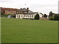


98 photos from this area
Area Information
Key information about the W13 0BA including its size, population, and administrative classification.
- Area Type
- Postcode
- Area Size
- 4.2 hectares
- Population
- 1888
- Population Density
- 8343 people/km²
House Prices in W13 0BA
27
Properties
£362,000
Average Sold Price
£75,000
Lowest Price
£780,000
Highest Price
Showing 27 properties
| Address | Type | Beds | Baths | Last Sale Price | Last Sale Date | |
|---|---|---|---|---|---|---|
| 24 Peal Gardens, West Ealing, W13 0BA | Terraced | 4 | 3 | £780,000 | Dec 2025 | |
| 25 Peal Gardens, West Ealing, W13 0BA | Terraced | 2 | 1 | £485,000 | Feb 2025 | |
| 14 Peal Gardens, West Ealing, W13 0BA | house | - | - | £480,000 | Aug 2023 | |
| 23 Peal Gardens, West Ealing, W13 0BA | Terraced | 2 | 2 | £460,000 | Nov 2020 | |
| 4 Peal Gardens, West Ealing, W13 0BA | Flat | 2 | - | £315,000 | Jun 2019 | |
| 27 Peal Gardens, West Ealing, W13 0BA | house | 2 | - | £390,000 | Feb 2018 | |
| 26 Peal Gardens, West Ealing, W13 0BA | Terraced | 2 | 1 | £385,000 | Mar 2016 | |
| 21 Peal Gardens, West Ealing, W13 0BA | house | - | - | £380,000 | Nov 2015 | |
| 9 Peal Gardens, West Ealing, W13 0BA | Flat | - | - | £249,000 | May 2008 | |
| 19 Peal Gardens, West Ealing, W13 0BA | house | - | - | £270,000 | Apr 2007 |
Page 1 of 3
Energy Efficiency in W13 0BA
Amenities
Schools
| Rank | School | Type | Entry gender | Ages |
|---|
Explore more schools in this area
Go to Schools tabDemographics
Household Size
Family (3-5 people)
most common
Accommodation Type
Flats
most common
Tenure
25
majority
Ethnic Group
White
most common
Religion
N/A
most common
Household Composition
N/A
most common
Age
47
median
Adults (30-64 years)
most common
Household Deprivation
N/A
with no deprivation
NS-SEC
22
in Lower managerial occupations
Explore more demographic insights in this area
Go to Demographics tabPlanning
Planning Constraints
- Flood RiskPremium
- Ramsar Wetland SitesPremium
- Area of Outstanding Natural BeautyPremium
- Protected Nature ReservePremium
- Protected WoodlandPremium