Area Overview for W12 9JA
Photos of W12 9JA


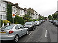
100 photos from this area
Area Information
Key information about the W12 9JA including its size, population, and administrative classification.
- Area Type
- Postcode
- Area Size
- 9439 m²
- Population
- 1759
- Population Density
- 19245 people/km²
House Prices in W12 9JA
100
Properties
£1,408,000
Average Sold Price
£730,000
Lowest Price
£1,820,000
Highest Price
Showing 100 properties
| Address | Type | Beds | Baths | Last Sale Price | Last Sale Date | |
|---|---|---|---|---|---|---|
| 38 Cathnor Road, London, W12 9JA | Terraced | 4 | 2 | £1,770,000 | Nov 2024 | |
| 30 Cathnor Road, London, W12 9JA | house | - | - | £1,420,000 | Feb 2024 | |
| 6A Cathnor Road, London, W12 9JA | Terraced | 1 | 2 | £1,300,000 | Mar 2023 | |
| 58 Cathnor Road, London, W12 9JA | Flat | 1 | 1 | £1,820,000 | Nov 2020 | |
| 28 Cathnor Road, London, W12 9JA | Flat | - | - | £730,000 | Jan 2006 | |
| Flat A Basement, 52 Cathnor Road, London, W12 9JA | Flat | 2 | 2 | - | - | |
| Flat Basement, 92 Cathnor Road, London, W12 9JA | Flat | 2 | 1 | - | - | |
| Flat 4, 22 Cathnor Road, London, W12 9JA | Flat | 2 | 1 | - | - | |
| Flat C, 68 Cathnor Road, London, W12 9JA | Flat | 2 | 2 | - | - | |
| 6 Cathnor Road, London, W12 9JA | Flat | 2 | 2 | - | - |
Page 1 of 10
Energy Efficiency in W12 9JA
Amenities
Schools
| Rank | School | Type | Entry gender | Ages |
|---|
Explore more schools in this area
Go to Schools tabDemographics
Household Size
One person
most common
Accommodation Type
Flats
most common
Tenure
26
majority
Ethnic Group
White
most common
Religion
N/A
most common
Household Composition
N/A
most common
Age
47
median
Adults (30-64 years)
most common
Household Deprivation
N/A
with no deprivation
NS-SEC
43
in Lower managerial occupations
Explore more demographic insights in this area
Go to Demographics tabPlanning
Planning Constraints
- Flood RiskPremium
- Ramsar Wetland SitesPremium
- Area of Outstanding Natural BeautyPremium
- Protected Nature ReservePremium
- Protected WoodlandPremium